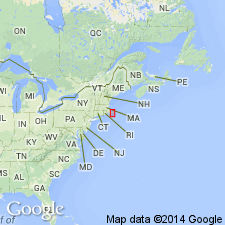
- Usage in publication:
-
- Newbury Volcanic Complex*
- Modifications:
-
- Overview
- AAPG geologic province:
-
- New England province
Summary:
Used as Newbury Volcanic Complex of Late Silurian and Early Devonian age. Mapped undivided in places; subdivided into informal units (ascending): lower members consisting of basalt, andesite, rhyolite, and tuff; porphyritic andesite including tuffaceous mudstone beds containing fossils of Late Silurian through Early Devonian age; and upper members consisting of calcareous mudstone, red mudstone, and siliceous siltstone, including fossils of Late Silurian through Early Devonian age. Also includes micrographic rhyolite, separately mapped, which intrudes the above-mentioned subunits.
Source: GNU records (USGS DDS-6; Reston GNULEX).

- Usage in publication:
-
- Newbury Volcanic Complex*
- Modifications:
-
- Overview
- AAPG geologic province:
-
- New England province
Summary:
Newbury Volcanic Complex of Late Silurian and Early Devonian age consists of sedimentary and volcanic rocks confined to two wedge-shaped and lenticular fault-bounded basins aligned between Newburyport and the Middleton-Topsfield area. Volcanic materials are composed largely of basalt flows; flow-banded rhyolite, vitrophyre, and ash-flow tuff; and porphyritic andesite flows, breccias, and tuff, partly waterlain. Upper part of complex consists of shallow marine siliceous siltstone, red sandy mudstone containing some volcanic detritus, and calcareous mudstone. Porphyritic andesite contains shelly fauna indicating latest Silurian (Pridolian) age. Calcareous mudstone of upper part contains ostracodes having a greater age than the fauna in andesite, and could be as young as earliest Devonian (Gedinnian). Nether the top or bottom is known. Equivalent to Leighton Formation of Pembroke area, ME, on the basis of correlation of shelly fauna. Ames Knob Formation and Thorofare Andesite of Penobscot region, ME, are also temporal equivalents. On basis of similar lithologies, Newbury has been equated in the past to Mattapan and Lynn Volcanic Complexes, but they are now believed to be Proterozoic Z in age. Report includes geologic maps and correlation charts. [Chapters A-J in U.S. Geological Survey Professional Paper 1366 are intended as explanations and (or) revisions to 1:250,000-scale MA State bedrock geologic map of Zen and others (1983).]
Source: GNU records (USGS DDS-6; Reston GNULEX).
For more information, please contact Nancy Stamm, Geologic Names Committee Secretary.
Asterisk (*) indicates published by U.S. Geological Survey authors.
"No current usage" (†) implies that a name has been abandoned or has fallen into disuse. Former usage and, if known, replacement name given in parentheses ( ).
Slash (/) indicates name conflicts with nomenclatural guidelines (CSN, 1933; ACSN, 1961, 1970; NACSN, 1983, 2005, 2021). May be explained within brackets ([ ]).

