The National Geologic Map Database is migrating to a new infrastructure. We apologize for any service disruptions during this process.
|
|---|


- Usage in publication:
-
- New Rome Formation
- Modifications:
-
- Revised
- AAPG geologic province:
-
- Wisconsin arch
Summary:
The New Rome Member (Brownell, IN Attig and others, in press) is included in both the Horicon and Big Flats Formations, where it consists of silt and clay underlying the surface sand of both formations. It is assigned to the Horicon in the northeast part of the study area and eventually pinches out in Portage Co. It thickens to the south through Wood, Juneau, and Sauk Cos. Overlies a few tens of meters of Horicon or Big Flats sand and some additional silt and clay beds too poorly known to be formally named. The New Rome and the unnamed members above and below it were deposited at the same time as the Mapleview Member of the Horicon Formation and are therefore considered lateral equivalents.
Source: GNU records (USGS DDS-6; Reston GNULEX).
- Usage in publication:
-
- New Rome Member
- Modifications:
-
- Principal reference
- Dominant lithology:
-
- Silt
- Sand
- Clay
- AAPG geologic province:
-
- Wisconsin arch
Summary:
Pg. vi (chart), 22-24. New Rome Member of Big Flats Formation. (Follows informal usage of Jim Brownell, 1986, Univ. Wisconsin MS thesis.) Thinly laminated, commonly rhythmically bedded, glaciolacustrine sediment. Contains rhythmites, typically reddish brown clay bed and a gray silt bed. Where rhythmites not apparent, color is brown. Total thickness at type 2.4 m; ranges from <0.3 to 9+ m. At type, overlies and underlies sand of Big Flats Formation. Interpreted as having been deposited in glacial Lake Wisconsin when Green Bay Lobe blocked the Wisconsin River at east end of Baraboo Hills and at Devils Nose, [Devils Lake State Park, South Range, Sauk County, south-central Wisconsin]. For most part, is contemporaneous with Mapleview Member of Horicon Formation. Age is Pleistocene (late Wisconsinan, about 20,000 to 14,000 yr B.P.).
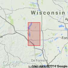
Type section: clay pit in a terrace scarp of Wisconsin River, about 0.3 km north of Apache Ave., in NE/4 SE/4 SE/4 sec., 15, T. 20 N., R. 5 E., [approx. Lat. 44 deg. 12 min. 06 sec. N., Long. 89 deg. 52 min. 50 sec. W.], Arkdale NW 7.5-min quadrangle, Adams Co., central WI.
Named from community of New Rome, northwestern Adams Co., central WI; name credited to Jim Brownell.
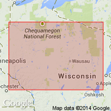
Reference section (subsurface; =Big Flats Formation type section): drillhole located in the unincorporated community of Big Flats, 100 m east of State Highway 13 on County Trunk Highway C, in NW/4 NW/4 NE/4 sec. 20, T. 19 N., R. 6 E., [approx. Lat. 44 deg. 06 min. 42 sec. N., Long. 89 deg. 48 min. 22 sec. W.], Roche A Cri 7.5-min quadrangle, Adams Co., central WI.
[Additional locality information from USGS historical topographic map collection TopoView and Wisconsin Highways, www.wisconsinhighways.org; accessed on June 9, 2018.]
Source: Publication.
For more information, please contact Nancy Stamm, Geologic Names Committee Secretary.
Asterisk (*) indicates published by U.S. Geological Survey authors.
"No current usage" (†) implies that a name has been abandoned or has fallen into disuse. Former usage and, if known, replacement name given in parentheses ( ).
Slash (/) indicates name conflicts with nomenclatural guidelines (CSN, 1933; ACSN, 1961, 1970; NACSN, 1983, 2005, 2021). May be explained within brackets ([ ]).