

- Usage in publication:
-
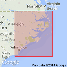
- New Hanover Member*
- Modifications:
-
- Named
- Dominant lithology:
-
- Limestone
- AAPG geologic province:
-
- Atlantic Coast basin
Summary:
Named basal member of Castle Hayne Formation. Named for New Hanover County, eastern North Carolina. Exposed in three large quarries in Castle Hayne area: East Coast Limestone Company Quarry west of Maple Hill in Pender County, Martin Marietta Co.'s Castle Hayne quarry (type locality), and Ideal Cement Co. quarry east of Castle Hayne. Occupies erosional channels in underlying Late Cretaceous Peedee Formation. Consists of slightly arenitic, micritic, phosphatic lithocalcirudite consisting of cobble- to pebble-sized, sandy, calcareous clasts, usually subrounded to well rounded, often coated with phosphate and glauconite. Also contains occasional quartz pebbles, flat clay chips, very fine sand, glauconite, and phosphate in cream-colored micrite matrix. Commonly includes shark and ray teeth, occasional worm bone, calcitic mollusks such as PECTEN and OSTREA, echinoids, crabs, and molluscan molds. Thickness ranges from 0 to 2 m. Overlain by Comfort Member of Castle Hayne Formation in abrupt uneven contact; a short hiatus is indicated. New Hanover Member contains molluscan molds of nautiloid cephalopods, gastropods, and various bivalve species, many of which are present in overlying Comfort Member. Correlates with Nanjemoy Formation of Virginia and lower part of Santee Formation in South Carolina. Presence of CUBITOSTREA SELLAEFORMIS in New Hanover Member at type locality suggests middle middle Eocene; equivalent to Lisbon Formation of Alabama.
Source: GNU records (USGS DDS-6; Reston GNULEX).
For more information, please contact Nancy Stamm, Geologic Names Committee Secretary.
Asterisk (*) indicates published by U.S. Geological Survey authors.
"No current usage" (†) implies that a name has been abandoned or has fallen into disuse. Former usage and, if known, replacement name given in parentheses ( ).
Slash (/) indicates name conflicts with nomenclatural guidelines (CSN, 1933; ACSN, 1961, 1970; NACSN, 1983, 2005, 2021). May be explained within brackets ([ ]).