The National Geologic Map Database is migrating to a new infrastructure. We apologize for any service disruptions during this process.
|
|---|


- Usage in publication:
-
- New Fork tongue
- Modifications:
-
- Original reference
- Dominant lithology:
-
- Shale
- Sandstone
- Conglomerate
- AAPG geologic province:
-
- Green River basin
Summary:
Pg. 60, 61, 64. New Fork tongue of Wasatch formation. Composed of variegated red, brick-brown, purple, yellow-brown, green, and gray clay shales; fine arkosic conglomerates; and coarse-grained cross-laminated sandstones. Overlies Knight member; interfingers with Fontenelle member (new) of Green River formation. Thickness as much as 325 feet. Age is Eocene.
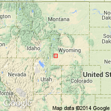
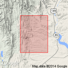
Typically exposed in buttes overlooking Green River-New Fork River junction, Sublette Co., southwestern WY.
Source: GNU records (USGS DDS-6; Denver GNULEX).
- Usage in publication:
-
- New Fork tongue*
- Modifications:
-
- Revised
- AAPG geologic province:
-
- Green River basin
Summary:
Revised in the Fort Hill area, Lincoln Co, WY in the Greater Green River basin as the New Fork tongue of the Wasatch formation to include a 250 ft thick wedge of detrital rocks that were formerly assigned (Donovan, 1950) to Fontenelle tongue of the Green River. The detrital rocks are green (not red) and gray mudstone, and numerous lenses of yellow, buff, and brown, very fine- to medium-grained sandstone. Rocks similar to these make up the bulk of the New Fork at the junction of the Green River and the New Fork River. Reds typical of Wasatch are missing. Rocks newly assigned to the New Fork are: 1) similar in composition, primary structures, and faunal content to Wasatch; 2) similar to other rocks, including color, assigned to the Wasatch; and 3) part of extensive detrital deposits along west margin of Lake Gosiute. New Fork overlies main body of Wasatch and underlies middle tongue of Green River Formation. Generalized diagram. Of early Eocene age.
Source: GNU records (USGS DDS-6; Denver GNULEX).
- Usage in publication:
-
- New Fork Tongue
- Modifications:
-
- Overview
- Areal extent
- AAPG geologic province:
-
- Green River basin
Summary:
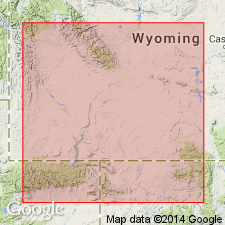
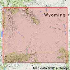
Is the lowermost of a series of clastic wedges of the Wasatch Formation. Occurs along the west margin of the Greater Green River basin of southwest WY in northwest Sweetwater, southern Sublette, and eastern Lincoln Cos. Occurs as two lobes. Thickens northward to more than 400 ft in southern Sublette Co. Isopach map. Merges with the main body of the Wasatch near the Overthrust Belt. Is 250 ft thick at its "type section" near Big Piney which is in the western facies--green and gray mudstone interbedded with buff and brown sandstone, a fluviatile facies. Resembles the main body except for the lack of purple and red coloration. The eastern facies is the redbed arkosic rocks of fluviatile origin whose source lay in the Wind River Mountains. Overlies Tipton Member (rather than Fontenelle Tongue which this author thinks should be discarded in favor of Tipton) of the Green River formation. Underlies Wilkins Peak Member of the Green River Formation. Of early Eocene, Lost Cabinian age.
Source: GNU records (USGS DDS-6; Denver GNULEX).
- Usage in publication:
-
- New Fork Tongue
- Modifications:
-
- Not used
Summary:
Name New Fork Tongue of Wasatch Formation was originally applied in the western part of the Greater Green River basin to rocks above the Fontenelle Tongue of the Green River Formation and below Laney Member of Green River. Later workers stratigraphically restricted the Fontenelle and applied name New Fork to older rocks above the restricted Fontenelle that were not part of the original New Fork. Term New Fork has been used for units with different stratigraphic boundaries and is not used in this report. Donavan's (1950) New Fork is Cathedral Bluffs Tongue of the Wasatch of this report. Oriel's (1961) New Fork is the Alkali Creek Tongue (new) of the Wasatch and the Farson Sandstone Member (new) of the Green River Formation of this report. Lawrence's (1963) and Sullivan's (1980) New Fork is the Alkali Creek Tongue of this report. Stratigraphic diagrams.
Source: GNU records (USGS DDS-6; Denver GNULEX).
For more information, please contact Nancy Stamm, Geologic Names Committee Secretary.
Asterisk (*) indicates published by U.S. Geological Survey authors.
"No current usage" (†) implies that a name has been abandoned or has fallen into disuse. Former usage and, if known, replacement name given in parentheses ( ).
Slash (/) indicates name conflicts with nomenclatural guidelines (CSN, 1933; ACSN, 1961, 1970; NACSN, 1983, 2005, 2021). May be explained within brackets ([ ]).