- Usage in publication:
-
- Nevins Drift
- Modifications:
-
- Named
- Dominant lithology:
-
- Till
- AAPG geologic province:
-
- Illinois basin
Summary:
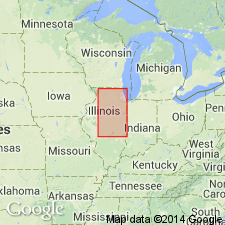
The only formal morphostratigraphic units recognized in IL are units related to moraines that are called "drifts." Is named for Nevins, Edgar Co, IL (Illinois basin); is based on the Nevins Moraine (mapped on pl. 1), which is the middle of the three moraines of the Shelbyville Morainic System. The moraine is differentiated through about the same area as the Westfield Moraine (about 40 mi long) and is about the same width (1 to 2 mi) and height (100 ft). It is separated from the adjacent moraines by a narrow, discontinuous, frontal valley and, where the valley is absent, is extended by tracing its crest. Deposited by the Decatur Sublobe of the Erie Lobe. Assigned to Woodfordian Substage of Wisconsinan Stage in Pleistocene Series.
Source: GNU records (USGS DDS-6; Denver GNULEX).
For more information, please contact Nancy Stamm, Geologic Names Committee Secretary.
Asterisk (*) indicates published by U.S. Geological Survey authors.
"No current usage" (†) implies that a name has been abandoned or has fallen into disuse. Former usage and, if known, replacement name given in parentheses ( ).
Slash (/) indicates name conflicts with nomenclatural guidelines (CSN, 1933; ACSN, 1961, 1970; NACSN, 1983, 2005, 2021). May be explained within brackets ([ ]).

