

- Usage in publication:
-
- Neslen coal-bearing member*
- Modifications:
-
- Named
- Dominant lithology:
-
- Sandstone
- Shale
- AAPG geologic province:
-
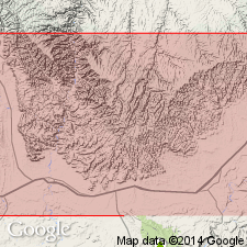
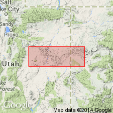
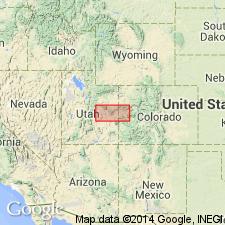
- Paradox basin
Summary:
Named as one of four members of the Price River formation of Mesaverde group for Neslen Canyon, T20S, R20E, Grand Co, UT in the Paradox basin. No type locality designated. Composed of equal proportions of sandstone weathering buff and shale weathering gray. Forms minor ledges and slopes. Overlies Sego sandstone member (new) and underlies Farrer non-coal-bearing member (new). Not distinguished west of Green River. Strata of same age extend east into CO where they are assigned to the Mount Garfield formation. Contains 3 distinct sandstones named Bluecastle, Thompson Canyon, and Sulphur Canyon sandstone beds, and 4 coal zones named the Palisade, Ballard, Chesterfield, and Cameo coal zones. Fossils from basal part are brackish-water or marine. Is 300+ ft thick in section measured in sec 17, T20S, R15E, Emery Co. Is 359 ft thick in W1/2 sec 4 and NE1/4 sec 5, T21S, R20E, 299 ft thick in NW1/4 sec 32, T20S, R21E, and 324+ ft thick in sec 31, T16S, R26E, all in Grand Co, UT. Brackish-water or marine fossils. Late Cretaceous age. Geologic maps.
Source: GNU records (USGS DDS-6; Denver GNULEX).
- Usage in publication:
-
- Neslen formation*
- Modifications:
-
- Revised
- AAPG geologic province:
-
- Paradox basin
Summary:
Raised in stratigraphic rank to Neslen formation of Mesaverde group. Overlies Sego sandstone (raised in rank). Underlies Farrer formation (raised in rank). Three sandstone members (formerly called beds) identified (ascending): Bluecastle sandstone, Thompson Canyon sandstone, and Sulphur Canyon sandstone members. Of late Campanian and Maestrichtian, Late Cretaceous age. Occurs in central Book Cliffs, UT in Paradox basin. Correlation chart.
Source: GNU records (USGS DDS-6; Denver GNULEX).
- Usage in publication:
-
- Neslen facies
- Modifications:
-
- Revised
- AAPG geologic province:
-
- Paradox basin
- Piceance basin
Summary:
Retained in the eastern Book Cliffs, UT and CO, Paradox and Piceance basins, as name for coal-bearing rocks of Price River formation, but rank changed from member to the informal designation facies. Replaces use of Mount Garfield formation which author considers to be an unnecessary term, simply a duplicate name for Neslen. Coal-bearing rocks of Neslen are nonmarine gray to black shale and thin lenticular buff sandstones of littoral marine and lagoonal origin. Rocks assigned to this facies range from 100 ft thick near Woodside, Emery Co, UT to 1,000 ft thick near the UT-CO state line in the Uinta basin. Divided into (ascending): Castlegate (name changed from Castlegate sandstone member of Price River), Sego (formerly Sego sandstone member of Price River), Corcoran (new), Cozzette (new), and Cameo (new) members. Cross sections. Late Cretaceous age. In contrast to this facies, the term Farrer facies applied to the non-coal-bearing rocks of the Price River formation in the western Book Cliffs of UT in the Paradox and Uinta basins. The contact between these two facies is transitional.
Source: GNU records (USGS DDS-6; Denver GNULEX).
- Usage in publication:
-
- Neslen formation*
- Modifications:
-
- Overview
- AAPG geologic province:
-
- Paradox basin
Summary:
Is a formation of the Mesaverde group above the Sego sandstone (rank raised) and beneath the Farrer formation. Bluecastle sandstone member considered to be a member of Price River formation in western Book Cliffs, west of Green River, Emery Co, UT, Paradox basin, and a member of Neslen formation in central Book Cliffs, east of Green River, Grand Co, UT in the Paradox basin. Includes Thompson Canyon and Sulphur Canyon sandstone beds. Lies between Sego sandstone (below) and Farrer formation (above). Contains a freshwater fauna in lower beds in western exposures and in higher beds in eastern exposures. Brackish-water fauna with a few marine species in lower beds. Fossils listed. Age cannot be designated more precisely than Late Cretaceous. Eight measured sections described. Columnar sections.
Source: GNU records (USGS DDS-6; Denver GNULEX).

- Usage in publication:
-
- Neslen Formation*
- Modifications:
-
- Revised
- Age modified
- AAPG geologic province:
-
- Paradox basin
Summary:
Is a unit of late Campanian age (an age refinement) in the Paradox basin. Palynomorphs identified in NE1/4 NE1/4 sec 29, T20S, R20E. Bluecastle Tongue, formerly part of Price River west of the Green River, and Neslen east of Green River, is removed from formations and reassigned to upper part of Castlegate Sandstone.
Source: GNU records (USGS DDS-6; Denver GNULEX).
- Usage in publication:
-
- Neslen Formation*
- Modifications:
-
- Biostratigraphic dating
- Overview
- Dominant lithology:
-
- Coal
- Shale
- Sandstone
- Siltstone
- AAPG geologic province:
-
- Paradox basin
Summary:
Palynomorph assemblage from samples in subsurface in Natural Buttes (sec 15, T10S, R22E) and Southman Canyon (sec 24, T10S, R23E) fields, Grand Co, UT, are of middle late Campanian age. Taxa in the assemblage are AQUILAPOLLENITES TRIALATUS, ERDTMANIPOLLIS sp., MANCICORPUS CALVUS, and SIBERIAPOLLIS MONTANENSIS. Neslen is equivalent in age to Judith River Formation of MT. Correlation chart; measured sections. Area studied includes Tuscher, Sego, and Cottonwood Canyons, and Bitter Creek, Grand Co, UT in the Paradox basin. Type section [principal reference] designated as the section measured in Sego Canyon, secs 3, 15, 28, 33, T20S, R20E, Grand Co, where formation about 300 ft thick is composed of coal and carbonaceous shale, at base; sandstone, carbonaceous siltstone, and interbedded sandstone, shale and carbonaceous shale, in upper part. Is 670 ft thick at Bitter Creek, UT near the CO State line. Is regionally an upward-coarsening sequence. Deposited on a coastal plain initially in fresh- and brackish-water and later in Neslen time in shallow-meandering eastward-flowing rivers on floodplains. Overlies Sego Sandstone. Underlies Farrer Formation.
Source: GNU records (USGS DDS-6; Denver GNULEX).
For more information, please contact Nancy Stamm, Geologic Names Committee Secretary.
Asterisk (*) indicates published by U.S. Geological Survey authors.
"No current usage" (†) implies that a name has been abandoned or has fallen into disuse. Former usage and, if known, replacement name given in parentheses ( ).
Slash (/) indicates name conflicts with nomenclatural guidelines (CSN, 1933; ACSN, 1961, 1970; NACSN, 1983, 2005, 2021). May be explained within brackets ([ ]).