The National Geologic Map Database is migrating to a new infrastructure. We apologize for any service disruptions during this process.
|
|---|


- Usage in publication:
-
- Nellie Bly formation*
- Modifications:
-
- Original reference
- Dominant lithology:
-
- Shale
- Sandstone
- AAPG geologic province:
-
- Chautauqua platform
Summary:
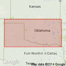
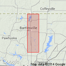
Pg. 74. Nellie Bly formation of Drum group. Named by D.W. Ohern in unpub. manuscript. Alternating shales and hard gray sandstones, the latter ranging in thickness from a few inches to several feet, from 15 feet on Kansas line to 200 feet in southeast Osage County [Oklahoma]. Is middle formation of Drum group. Rests on Hogshooter limestone and underlies Dewey limestone. Enters Oklahoma in northwestern Nowata County, and extends southwest across Nowata, Washington, southeast Osage, and Creek Counties as far as northern Okfuskee, where it merges with Francis formation. [Later reports give thickness up to 400+/- feet.] Age is Pennsylvanian.
Named from Nellie Bly Creek, southern Washington Co., OK.
[GNC remark (ca. 1935, US geologic names lexicon, USGS Bull. 896, p. 1474): Drum group is no longer used to include these rocks.]
Source: US geologic names lexicon (USGS Bull. 896, p. 1474).
- Usage in publication:
-
- Nellie Bly formation
- Modifications:
-
- Principal reference
- Revised
- AAPG geologic province:
-
- Chautauqua platform
Summary:
Nellie Bly formation included in Skiatook group. Name is applied to shales and sandstones above Hogshooter formation and below Dewey limestone, or below unconformity at base of Chanute formation where Dewey is absent. Maximum thickness 180 feet. Age is Late Pennsylvanian (Missourian).
Type locality stated: on Nellie Bly Creek, in secs. 31, 32, 29, 28, T. 24 N., R. 13 E., Washington Co., OK.
Source: US geologic names lexicon (USGS Bull. 1200, p. 2703).
- Usage in publication:
-
- Nellie Bly formation
- Modifications:
-
- Overview
- AAPG geologic province:
-
- Chautauqua platform
Summary:
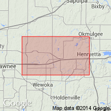
Pg. 64-68. In Okfuskee County [Oklahoma], consists of 6 mappable sandstones and 7 mappable shales. Thickness 440 to 460 feet. Conformably overlies Hogshooter; conformably underlies Dewey formation. Age is Late Pennsylvanian (Missourian).
Source: US geologic names lexicon (USGS Bull. 1200, p. 2703).
- Usage in publication:
-
- Nellie Bly formation
- Modifications:
-
- Overview
- AAPG geologic province:
-
- Chautauqua platform
Summary:
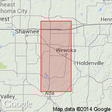
Pg. 70-78, pls. 1, 2. In Seminole County [Oklahoma], consists of shale, sandstone, siltstone, chert conglomerate, limestone and limestone conglomerate; only a single ledge, the basal (No. 1) sandstone, is continuous across [the] county. Thickness 300 to 400 feet. Conformable above Coffeyville formation and below the Belle City; in northern part of county, apparently conformable below Hilltop formation; in Pontotoc County, truncated by Ada formation. Age is Late Pennsylvanian (Missourian).
[Misprint: US geologic names lexicon (USGS Bull. 1200, p. 2703) cites W.F. Turner as author. Should be W.F. Tanner.]
Source: US geologic names lexicon (USGS Bull. 1200, p. 2703).
For more information, please contact Nancy Stamm, Geologic Names Committee Secretary.
Asterisk (*) indicates published by U.S. Geological Survey authors.
"No current usage" (†) implies that a name has been abandoned or has fallen into disuse. Former usage and, if known, replacement name given in parentheses ( ).
Slash (/) indicates name conflicts with nomenclatural guidelines (CSN, 1933; ACSN, 1961, 1970; NACSN, 1983, 2005, 2021). May be explained within brackets ([ ]).