

- Usage in publication:
-
- Nehawka limestone member
- Modifications:
-
- Original reference
- Dominant lithology:
-
- Limestone
- AAPG geologic province:
-
- Nemaha anticline
Summary:
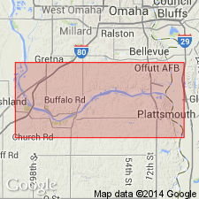
Pg. 6, 33. Nehawka limestone member of Andrew (Lawrence) shale. Hard gray bedded limestone forming base of Andrew (Lawrence) shale in Weeping Water section, Nebraska. Exposed in bed of North Branch of the Weeping Water 2 miles north of Nehawka. Best shown in sec. 6, T. 10 N., R. 13 E. Largest exposures show thickness of 4 feet 6 inches (under wagon bridge just north of center of sec. 6, T. 10 N., R. 13 E.), but correlated neighboring exposures indicate total thickness of 10 feet or more. Age is Pennsylvanian. Report includes measured sections, cross sections.
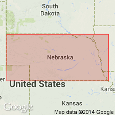
Type locality: in bed of North Branch of the Weeping Water, 2 mi north of Nehawka, Cass Co., southeastern NE. Named from the town of Nehawka, Cass Co., southeastern NE.
Source: US geologic names lexicons (USGS Bull. 896, p. 1473; USGS Bull. 1200, p. 2701-2702); GNC KS-NE Pennsylvanian Corr. Chart, sheet 1, Oct. 1936; supplemental information from GNU records (USGS DDS-6; Denver GNULEX).

- Usage in publication:
-
- Nehawka limestone member
- Modifications:
-
- Not used
Summary:
Pg. 34. Nehawka limestone is Iatan limestone member, and latter name is now used.
Source: US geologic names lexicon (USGS Bull. 896, p. 1473).
- Usage in publication:
-
- Nehawka limestone
- Modifications:
-
- Overview
Summary:
Pg. 5-6. Unconformity at base of what is supposed to be Stranger formation is marked by erosion extending locally through Weston shale and probably into upper part of Stanton formation. Iatan limestone, if it was deposited here, apparently was eroded. Nehawka limestone, a conglomeratic facies, which is thought to be correlative with Tonganoxie sandstone of Kansas Survey classification, lies on lowest eroded surface of this unconformity.
Source: US geologic names lexicon (USGS Bull. 1200, p. 2702).
For more information, please contact Nancy Stamm, Geologic Names Committee Secretary.
Asterisk (*) indicates published by U.S. Geological Survey authors.
"No current usage" (†) implies that a name has been abandoned or has fallen into disuse. Former usage and, if known, replacement name given in parentheses ( ).
Slash (/) indicates name conflicts with nomenclatural guidelines (CSN, 1933; ACSN, 1961, 1970; NACSN, 1983, 2005, 2021). May be explained within brackets ([ ]).