The National Geologic Map Database is migrating to a new infrastructure. We apologize for any service disruptions during this process.
|
|---|


- Usage in publication:
-
- Needleseye Conglomerate Member
- Modifications:
-
- Original reference
- Dominant lithology:
-
- Sandstone
- AAPG geologic province:
-
- Appalachian basin
Summary:
Needleseye Conglomerate Member of Vandever Formation. At type section consists of 110 feet of thick-bedded, fine- to medium-grained, light-brownish-gray to light-brown conglomeratic sandstone, cross-bedded in part. Conformably underlies unnamed upper shale member of Vandever (silty shales). Overlies with slight disconformity unnamed lower shale member of Vandever (silty shales). Age is Pennsylvanian.
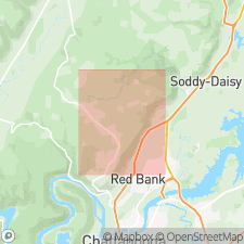
Type section: along road leading from Huckleberry (crossing Mowbray Creek) to Mowbray Church, in southwestern part of Soddy (111-SW) quadrangle, about 5 mi northeast of Needleseye which is located just west of Sawyer Cemetery at 2,215,900 E., 298,300 N. (TN coordinate system), southeastern TN.
Caps flat upper surface of much of southern part of Walden Ridge, [to west in Ketner Gap quadrangle, see R.C. Milici and others, 1972, Tennessee Div. Geol., Geol. Quad. Map GM 105-NW].
Source: US geologic names lexicon (USGS Bull. 1350, p. 522).
For more information, please contact Nancy Stamm, Geologic Names Committee Secretary.
Asterisk (*) indicates published by U.S. Geological Survey authors.
"No current usage" (†) implies that a name has been abandoned or has fallen into disuse. Former usage and, if known, replacement name given in parentheses ( ).
Slash (/) indicates name conflicts with nomenclatural guidelines (CSN, 1933; ACSN, 1961, 1970; NACSN, 1983, 2005, 2021). May be explained within brackets ([ ]).