

- Usage in publication:
-
- Needles Range formation
- Modifications:
-
- Named
- Dominant lithology:
-
- Tuff
- AAPG geologic province:
-
- Great Basin province
Summary:
Named for exposures designated the type locality on the east side of Needles Range at and south of Garrison-Milford Hwy, Beaver Co, UT in Great Basin province. Divided at some localities into Wah Wah Springs tuff [member] new, at base, and Minersville tuff [member] new, at top. Consists primarily of crystal-rich ignimbrites several hundreds of ft thick. Is usually pink to dark red-brown, but ranges from black in the welded vitrophyre phases near base of some of the units to light-gray in their uppermost parts. Rests on an erosion surface with a local relief as much as 500 ft cut in Paleozoic rocks, or in lower Tertiary? fluvial and lacustrine sedimentary rocks or older volcanics. Subjacent volcanics arbitrarily excluded on basis of lithology. Crystal-rich ignimbrites thought to be part of the Needles Range have been found at localities from the Paunsaugunt Plateau to Bryce Canyon. May have an areal extent of 10,000 sq mi and an average thickness of 500 ft. Overlain by Isom formation (new). Of Eocene or Oligocene age.
Source: GNU records (USGS DDS-6; Denver GNULEX).
- Usage in publication:
-
- Needles Range Formation
- Modifications:
-
- Revised
- AAPG geologic province:
-
- Great Basin province
Summary:
Overlies newly named Beers Spring Formation in Beaver Co., UT in the Great Basin province. Of Oligocene age. Stratigraphic chart.
Source: GNU records (USGS DDS-6; Denver GNULEX).
- Usage in publication:
-
- Needles Range Formation
- Modifications:
-
- Revised
- AAPG geologic province:
-
- Great Basin province
Summary:
Is a middle Tertiary unit distinguished by its ash-flow deposits. Extends over 33,600 sq mi of southwest UT and eastern NV. Characterized by abundant phenocrysts of plagioclase, biotite, and amphibole. Divided into (ascending): Cottonwood Wash Tuff Member (newly named), Wah Wah Springs Tuff Member, Lund Tuff Member (newly named), and Wallaces Peak Tuff Member (newly named). Geologic maps. Members can be separately mapped. Measured sections shown graphically. Minersville Tuff (Mackin, 1960) abandoned and replaced by Wah Wah Springs Tuff Member.
Source: GNU records (USGS DDS-6; Denver GNULEX).
- Usage in publication:
-
- Needles Range Formation*
- Modifications:
-
- Revised
- AAPG geologic province:
-
- Great Basin province
Summary:
History of usage given. Includes some rocks previously assigned to Dry Hollow Formation (restricted). Area covered by Needles Range Formation totals at least 50,000 sq km. Source is unknown, probably is west of the High Plateaus. Considered to be a resistant widespread tuff. Its members, usually less than 15 m thick and rarely more than 30 m, grade upward from a gray to black basal vitrophyre through a pink to dark-red-brown devitrified zone to a light-gray poorly welded uppermost part. Base of formation defined by a crystal-rich unit. Locally separated from the underlying Claron Formation by thin (15 to 50 m thick) crystal-poor ash-flow tuff, volcanic lava flows, mudflow breccia and arenite. Radiometric ages of 26.5 to 30.7 m.y. reported from previously published reports. Of Oligocene age. Correlation chart; block diagram.
Source: GNU records (USGS DDS-6; Denver GNULEX).
- Usage in publication:
-
- Needles Range Formation*
- Modifications:
-
- Revised
- AAPG geologic province:
-
- Great Basin province
Summary:
Unconformably overlies Mt. Laird Tuff (new) and fills paleovalleys in the Drum Mountains Rhyodacite (new). Is younger than Spor Mountain Formation (new). Of Oligocene age. Located in Great Basin province.
Source: GNU records (USGS DDS-6; Denver GNULEX).

- Usage in publication:
-
- Needles Range Formation*
- Modifications:
-
- Geochronologic dating
- AAPG geologic province:
-
- Great Basin province
Summary:
Pg. 29, geologic time scale (inside front cover). Needles Range Formation. Sample from a biotite-hornblende crystal-vitric ash-flow tuff, in SE/4 sec. 14, T. 29 S., R. 13 W., Lat. 38 deg. 16 min. 48 sec. N., Long. 113 deg. 16 min. 18 sec. W., Frisco quadrangle, Beaver County, Utah, yielded K-Ar ages of 29.9 +/-0.9 Ma (hornblende) and 29.8 +/-0.9 Ma (biotite). Marvin's (USGS Misc. Inv. Ser. Map I-537, 1968) ages of 29.2 Ma (hornblende) and 29.0 Ma (biotite) are recalculated using decay constants of Steiger and Jager, 1977 (Earth Planet. Sci. Letters, v. 36, p. 359-362). [Oligocene, based on time scale of Berggren, 1972, Lethaia, v. 5, no. 2, p. 195-215.]
Source: Publication.
- Usage in publication:
-
- Needles Range Group*
- Modifications:
-
- Areal extent
- Mapped 1:24k
- Dominant lithology:
-
- Tuff
- Rhyolite
- Andesite
- AAPG geologic province:
-
- Great Basin province
Summary:
Lower two formations, Escalante Desert Formation (at base) and Cottonwood Wash Tuff (above), are separately mapped in the Mountain Home Range in western Millard Co, southwestern UT (Great Basin province). Both formations contain 30-45 percent phenocrysts of plagioclase, mafic minerals, and quartz (Best and Grant, 1987). [See remarks under specific formations regarding map unit descriptions. No mention is made regarding the upper formations (ascending: Wah Wah Springs, Ryan Spring, and Lund Formations) of the Needles Range Group as revised by Best and Grant (1987).]
Source: GNU records (USGS DDS-6; Denver GNULEX).
- Usage in publication:
-
- Needles Range Group*
- Modifications:
-
- Overview
- AAPG geologic province:
-
- Great Basin province
Summary:
Divided in the southern Wah Wah Mountains and Indian Peak Range, southwest UT, Great Basin province into (ascending): Escalante Desert Formation, Cottonwood Wash Tuff, Wah Wah Springs, Ryan Spring, and Lund Formations. In these areas, Needles Range overlies Sawtooth Peak Formation and underlies Isom Formation. Consists of 6,600 cubed kilometers of ash-flow tuffs and minor lava flows of 2 eruptive cycles. The first-cycle rhyolite tuffs and lava flows of the Escalante Desert erupted about 33 m. y. ago. This formation was succeeded by dacite ash flows 30.6 and 29.5 m. y. ago, the Cottonwood Wash and Wah Wah Springs. The second-cycle rhyolite ash-flow tuffs (Ryan Spring) and dacite (Lund) were emplaced 28 m. y. ago. Stratigraphic chart.
Source: GNU records (USGS DDS-6; Denver GNULEX).
- Usage in publication:
-
- Needles Range Group*
- Modifications:
-
- Revised
- Overview
- AAPG geologic province:
-
- Great Basin province
Summary:
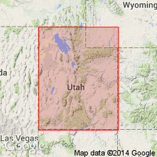
Raised in stratigraphic rank from Needles Range Formation to Needles Range Group in Iron, Beaver, and Millard Cos, UT and into Lincoln Co, NV. Divided into (ascending order): 1) Escalante Desert Formation (newly assigned to group), which can be separated into Marsden (new) and Lamerdorf Tuff Members that are intertongued with andesite flow member, rhyolite flow member, and Beers Spring Member; all? derived from Pine Valley caldera; 2) Cottonwood Wash Tuff, rank raised; 3) Wah Wah Springs Formation, rank raised and divided into outflow tuff (base) and intracaldera (top) members; derived from Indian Peak caldera; 4) Ryan Spring Formation (new), which is divided into Greens Canyon and Mackleprang Tuff Members (new), and andesite flow and rhyolite flow members derived from Indian Peak caldera; 5) Lund Formation, rank raised, which is divided into tuff and andesite flow members, both derived from White Rock caldera. All except Wah Wah Springs have normal polarity. Two cycles--each began with crystal-poor, lithic-rich rhyolite and culminated with more voluminous crystal-rich dacite. First cycle began about 33 m.y. ago, second began about 29.5 and ended 28 m.y. ago, or Oligocene. Total of 6,600 cubic km material produced from Indian Peak caldera complex. Erupted from overlapping sources along UT-NV border. Overlies Sawtooth Peak Formation; underlies Isom Formation. Stratigraphic chart.
Source: GNU records (USGS DDS-6; Denver GNULEX).
- Usage in publication:
-
- Needles Range Group*
- Modifications:
-
- Revised
- Overview
- AAPG geologic province:
-
- Great Basin province
Summary:
Newly named Ripgut Formation, formerly called formation of Ripgut Springs, assigned as uppermost formation (of 6) of Needles Range Group. Ripgut lies above the Lund Formation of the Needles Range Group and beneath the Isom Formation. The group lies along the Reno-San Juan magmatic zone which extended across NV, UT, and southwest CO in Oligocene and Miocene time. Three eruptive cycles present in Needles Range. The first was modest with rhyolitic ash flows and the other two were terminated by ejection of voluminous ash flows of crystal-rich dacite. Ash-flows of the magma system were derived from the Indian Peak caldera complex; they covered 53,000 sq km in eastern Great Basin province. Minor amounts of rhyolite and pyroxene andesite lava flows erupted throughout Needles Range time within or near the source, particularly in the early part. An ash bed near the base of the Arikaree Formation in NE has the same age and crystal composition appropriate for dacite tuffs of the Needles Range Group. Oligocene age. Stratigraphic table. Areal extent maps. Formations of Needle Range --and their sources: 1) Escalante Desert --Pine Valley caldera; 2) Cottonwood Wash --south of Snake Range; 3) Wah Wah Springs --Indian Peak caldera; 4) Ryan Spring --within older Indian Peak caldera; 5) Lund --White Rock caldera; 6) Ripgut --Mt. Wilson caldera.
Source: GNU records (USGS DDS-6; Denver GNULEX).
- Usage in publication:
-
- Needles Range Group*
- Modifications:
-
- Contact revised
- AAPG geologic province:
-
- Paradox basin
Summary:
Lower contact revised in that some volcaniclastic fluvial, lacustrine, and tuffaceous rocks formerly assigned to the upper part of the white member of the Claron Formation, or to an unnamed sequence above the white member and beneath the Needles Range Group in the Hatch quad. and on the Markagunt Plateau to the west, Garfield Co, UT, Paradox basin are named Limerock Canyon Formation. Correlation chart. Oligocene age.
Source: GNU records (USGS DDS-6; Denver GNULEX).
For more information, please contact Nancy Stamm, Geologic Names Committee Secretary.
Asterisk (*) indicates published by U.S. Geological Survey authors.
"No current usage" (†) implies that a name has been abandoned or has fallen into disuse. Former usage and, if known, replacement name given in parentheses ( ).
Slash (/) indicates name conflicts with nomenclatural guidelines (CSN, 1933; ACSN, 1961, 1970; NACSN, 1983, 2005, 2021). May be explained within brackets ([ ]).