- Usage in publication:
-
- Needle formation
- Modifications:
-
- First used
- Dominant lithology:
-
- Tuff
- Breccia
- Sandstone
- Conglomerate
- Porphyry
- AAPG geologic province:
-
- Basin-and-Range province
Summary:
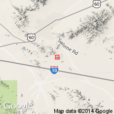
First published use as an informal term for some (up to 900 m) volcanic, volcaniclastic, and hypabyssal rocks in the Centennial plate in Little Harquahala and western Harquahala Mountains, La Paz Co, AZ, Basin-and-Range province. Divisible into a lower volcanic and volcaniclastic unit, a middle intrusive or extrusive rhyodacite porphyry, and an upper dominantly sedimentary, volcanic-lithic unit. Intent to name, source of geographic name, designation of a type not included. Contact with underlying unnamed Mesozoic medium-grained feldspathic sandstone and pebble to cobble conglomerate or with Kaibab Limestone poorly exposed and everywhere tectonically disrupted. The lower unit has no internal consistent stratigraphy; it consists of gray silicic flows, ash-flow tuff, breccia, massive, laminated tuff, red volcanic-lithic sandstone, and conglomerate. Clasts in the conglomerate include limestone, volcanic rocks, quartzite, granitoids, blocks of Kaibab. The rhyodacite porphyry is a massive, homogeneous, gray-green quartz-feldspar porphyry up to 335 m thick. Upper unit is 335 m of massive conglomerate or breccia that becomes a sandstone upward. Clasts in the conglomerate derived from the porphyry. Geologic maps. Upper contact gradational into Apache Wash facies (also called formation). Similar lithologically to other Jurassic rocks in the area. Assigned to the Jurassic.
Source: GNU records (USGS DDS-6; Denver GNULEX).
For more information, please contact Nancy Stamm, Geologic Names Committee Secretary.
Asterisk (*) indicates published by U.S. Geological Survey authors.
"No current usage" (†) implies that a name has been abandoned or has fallen into disuse. Former usage and, if known, replacement name given in parentheses ( ).
Slash (/) indicates name conflicts with nomenclatural guidelines (CSN, 1933; ACSN, 1961, 1970; NACSN, 1983, 2005, 2021). May be explained within brackets ([ ]).

