

- Usage in publication:
-
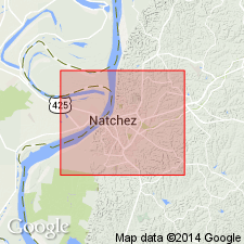
- Natchez formation
- Modifications:
-
- Named
- Dominant lithology:
-
- Gravel
- Sand
- Silt
- AAPG geologic province:
-
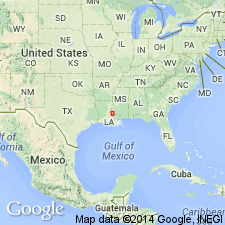
- Mid-Gulf Coast basin
Summary:
Natchez formation described as alternating stages of deposition and erosion of Pleistocene stratified gravel, sand, and fine silt of immediate valley of Mississippi River in vicinity of Natchez. The Natchez formation and associated deposits and stages of erosion are of special interest because of their probable relationship with Kansan, Aftonian, and Iowan stages of Glacial period in upper and more northern part of Mississippi basin.
Source: GNU records (USGS DDS-6; Reston GNULEX).
- Usage in publication:
-
- Natchez Formation
- Modifications:
-
- Overview
- AAPG geologic province:
-
- Mid-Gulf Coast basin
Summary:
The Natchez Formation is all that remains of a formerly much more extensive Pleistocene alluvial terrace deposit. It can be distinguished from the Citronelle formation by relative percentages of feldspar, which are higher in the Natchez. Unit was described as glacial outwash sediments that had traveled down the Mississippi sluiceway by Chamberlin and Salisbury (1907). In a table for field identification, criteria listed include: armored clay balls near base, reddish-brown color at base to light brown in upper portions, graveliferous at base and fining upward. Relatively high feldspar content gives sand a subarkosic to arkosic composition. Contains volcanic rock fragments and illite is the most common clay mineral.
Source: GNU records (USGS DDS-6; Reston GNULEX).
For more information, please contact Nancy Stamm, Geologic Names Committee Secretary.
Asterisk (*) indicates published by U.S. Geological Survey authors.
"No current usage" (†) implies that a name has been abandoned or has fallen into disuse. Former usage and, if known, replacement name given in parentheses ( ).
Slash (/) indicates name conflicts with nomenclatural guidelines (CSN, 1933; ACSN, 1961, 1970; NACSN, 1983, 2005, 2021). May be explained within brackets ([ ]).