- Usage in publication:
-
- Nashoba Formation*
- Modifications:
-
- Revised
- Age modified
- AAPG geologic province:
-
- New England province
Summary:
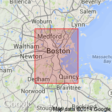
In Billerica, Concord, and Westford 7.5-min quads, Nashoba Formation is divided into 10 locally mappable lithostratigraphic members, based principally on differentiating biotite-rich gneiss strata from more heterogeneous strata. Biotite-rich members, which also include subordinate amphibolite, are here named (oldest to youngest) Tophet Swamp Gneiss Member, Nagog Pond Gneiss Member, and Long Pond Gneiss Member. Other strata include (in addition to biotite-rich gneiss and amphibolite) calc-silicate rocks, amphibolite-biotite gneisses, and less commonly, sillimanite mica schist or marble. These members are herein designated the Boxford Member (rank reduced), Bellows Hill Member, Billerica Schist Member, Spencer Brook Member, Nashoba Brook Member, Fort Pond Member, and Beaver Brook Member. Belongs to a sequence of eugeosynclinal rocks lying stratigraphically above Middlesex Fells Volcanic Complex. This sequence has no fossils, none of its formations are in contact with fossiliferous rocks, and have no features that would suggest an age. Degree of metamorphism also does not provide evidence of age. Isotopic ages of rocks that intrude the sequence (Andover Granite and Sharpners Pond Tonalite) are given as Devonian by Zartman and others (1970). Although these isotopic ages may differ somewhat from age of intrusion due to widespread thermal activity that altered isotopic ratios of rocks in this region, general designation of pre-Silurian for all host rocks in the sequence is consistent.
Source: GNU records (USGS DDS-6; Reston GNULEX).

- Usage in publication:
-
- Nashoba Formation*
- Modifications:
-
- Age modified
- Geochronologic dating
- AAPG geologic province:
-
- New England province
Summary:
Age of Nashoba Formation changed to Ordovician or Proterozoic Z based on likely equivalence with Tatnic Hill Formation. Nashoba is intruded by Andover Granite which is dated by Rb-Sr methods as Late Ordovician to Early Silurian (R.E. Zartman, unpub. data, 1978, and Handford, 1965); this indicates that Nashoba and Tatnic Hill are Ordovician or older. Foliated pegmatite in Tatnic Hill has discordant Pb-Pb zircon age of 520 m.y. (Zartman and others, 1965) indicating a Cambrian or older age, but origin and history of zircons is uncertain. U-Pb concordia plots from suite of euhedral to subhedral zircons from metavolcaniclastic(?) rocks conformably below Nashoba Formation in eastern MA (Fish Brook and Shawsheen Gneisses) yield an age of 742 m.y. (Olszewski, 1978); this age suggests that Nashoba and Tatnic Hill could be Proterozoic Z. However, zircons from Middlesex Fells Volcanic Complex were probably included in the suite, according to Olszewski, so that age is suspect. Therefore, age of Nashoba and Tatnic Hill Formations is Ordovician or Proterozoic Z.
Source: GNU records (USGS DDS-6; Reston GNULEX).

- Usage in publication:
-
- Nashoba Formation*
- Modifications:
-
- Overview
- AAPG geologic province:
-
- New England province
Summary:
Used as Nashoba Formation of Proterozoic Z or Ordovician age. Only lowermost Boxford Member separately mapped as mostly amphibolite and minor biotite gneiss. Rest is mapped undivided as sillimanite schist and gneiss, amphibolite, biotite gneiss, calc-silicate gneiss, and marble.
Source: GNU records (USGS DDS-6; Reston GNULEX).

- Usage in publication:
-
- Nashoba Formation*
- Modifications:
-
- Overview
- AAPG geologic province:
-
- New England province
Summary:
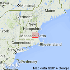
Nashoba Formation occurs in Nashoba zone of eastern MA. Consists of interlayered sillimanite-bearing, partly sulfidic schist and gneiss, calc-silicate gneiss, and subordinate quartzite and marble. Protoliths were probably volcanogenic sediments interlayered with limy marine sediments. Bell and Alvord (1976) divided Nashoba into 10 members on basis of lithology. Amphibolite is most abundant near presumed base, namely in Boxford Member. Skehan and Abu-Moustafa (1976) divided Nashoba into 30 members based on section in Wachusett-Marlborough tunnel. Although Bell and Alvord's and Skehan and Moustafa's sections contain similar lithologies, Bell and Alvord's is much thicker, and Boxford Member is not readily identified in Skehan and Abu-Moustafa's. Subdivision of Nashoba is conjectural south of Marlborough and Shrewsbury. On MA State bedrock map (Zen and others, 1983) only Boxford Member is separated out from the rest of the Nashoba because this unit was the only member clearly recognized in several area. A definite sequence of members probably does not exist anywhere in the Nashoba because of lenticularity of assemblages and repeated rock types, both of which could be accounted for by either sedimentary or tectonic processes. Although Castle (1965) considered Fish Brook to be either a premetamorphic intrusive rock or a core gneiss of intrusive or sedimentary ancestry, Bell and Alvord (1976) considered it to be volcanic or volcaniclastic in origin. Zircons in Fish Brook are certainly volcanic in origin and yield a date of 730 +/-26 Ma (Olszewski, 1980). If the rock were a core gneiss, that date would apply only to the Fish Brook and not to surrounding rocks; but, Bell and Alvord (1976) believe Fish Brook to be part of the Marlboro Formation-Nashoba Formation sequence and therefore the date does apply to the sequence. In addition, a 1500 Ma date for Shawsheen Gneiss [reference not given] helps bracket age of Marlboro-Nashoba sequence. An upper limit for the sequence was established from the 430 +/-5 Ma age of intruding Sharpers Pond Diorite and 450 +/-23 Ma age of the intruding Andover Granite (Zartman and Naylor, 1984). Although age on MA State bedrock map is shown as Proterozoic Z or Ordovician (due to uncertainty regarding actual rocks sampled by Olszewski and a strong belief that rocks of Nashoba zone correlated with Ordovician rocks to the west), author now feels that rocks of Nashoba zone (except for Tadmuck Brook Schist) are all Proterozoic, but that they are unlike the Proterozoic rocks of neighboring Milford-Dedham zone. [no formal age change made in this report]. Report includes geologic maps and correlation charts. [Chapters A-J in U.S. Geological Survey Professional Paper 1366 are intended as explanations and (or) revisions to 1:250,000-scale MA State bedrock geologic map of Zen and others (1983).]
Source: GNU records (USGS DDS-6; Reston GNULEX).

- Usage in publication:
-
- Nashoba Formation
- Modifications:
-
- Age modified
- AAPG geologic province:
-
- New England province
Summary:
Fish Brook Gneiss of the Nashoba terrane has been dated by G.R. Dunning at 520+14-11 Ma. This not only establishes a Cambrian age for this unit, but constrains the age of the overlying Marlboro and Nashoba Formations to the interval between 520 Ma and 430 Ma, the age of the cross-cutting Sharpners Pond Diorite. No Precambrian rocks, therefore, are known from the Nashoba terrane.
Source: GNU records (USGS DDS-6; Reston GNULEX).
For more information, please contact Nancy Stamm, Geologic Names Committee Secretary.
Asterisk (*) indicates published by U.S. Geological Survey authors.
"No current usage" (†) implies that a name has been abandoned or has fallen into disuse. Former usage and, if known, replacement name given in parentheses ( ).
Slash (/) indicates name conflicts with nomenclatural guidelines (CSN, 1933; ACSN, 1961, 1970; NACSN, 1983, 2005, 2021). May be explained within brackets ([ ]).

