

- Usage in publication:
-
- Narragansett Bay Group
- Modifications:
-
- [Principal reference]
- AAPG geologic province:
-
- New England province
Summary:
Pg. A4-A9, A20-A24. Narragansett Bay Group. Name applied to Pennsylvanian age clastic terrigenous sedimentary rocks in the Narragansett basin, Massachusetts and Rhode Island. Estimated maximum thickness around 13,000 feet (3,900 m). Age is Westphalian A to possibly Stephanian B, based on fossils. Includes 5 formations [descending and in places interfingering, generally following classification of T.A. Mutch, 1968, GSA Spec. Paper 106, fig. 2]: Purgatory Conglomerate and Dighton Conglomerate [the Purgatory is possibly correlative with the Dighton and not the Wamsutta Formation, as indicated by Mutch], Rhode Island Formation, Wamsutta Formation, and Pondville Conglomerate.
Source: Publication.
- Usage in publication:
-
- Narragansett Bay Group
- Modifications:
-
- Overview
- Dominant lithology:
-
- Conglomerate
- AAPG geologic province:
-
- New England province
Summary:
Narragansett Bay Group described as a suite of Carboniferous- to Permian-aged, clastic sedimentary rocks that forms the western and northern boundary of the New Bedford area. On geologic map shown in contact with the Fall River Granite (formalized in this report). Subunits not discussed. Rocks were multiply deformed and metamorphosed during the Permian (Alleghanian orogeny). Reader is referred here to Quinn (1971), Skehan and others (1979), Murray and others (1981), Mosher (1983), and Skehan and others (1986) for a more comprehensive discussion.
Source: GNU records (USGS DDS-6; Reston GNULEX).
- Usage in publication:
-
- Narragansett Bay Group
- Modifications:
-
- Mapped
- Dominant lithology:
-
- Conglomerate
- Sandstone
- Shale
- AAPG geologic province:
-
- New England province
Summary:
(credited to Sharon Mosher, Univ. Texas-Austin, and co-workers.) Narragansett Bay Group. Nonmarine sedimentary rocks. Divided into 6 formations (alphabetical): (1) Dighton Conglomerate, gray quartz conglomerate with minor lenses of litharenite and arkosic sandstone; (2) Pondville Conglomerate, gray to greenish conglomerate interbedded with sandstone, litharenite, slate, and siltstone; (3) Purgatory Conglomerate, buff to light-gray conglomerate with elongate quartzite clasts; (4) Rhode Island Formation, sandstone, shale, and conglomerate, with minor coal layers; (5) Sachuest Arkose, smoky-quartz granule conglomerate, sandstone, and phyllite; and (6) Wamsutta Formation, red sandstone, shale, and conglomerate with locally abundant volcanic detritus as clasts and matrix. [Thicknesses not stated.] Older than Narragansett Pier Plutonic Suite (Permian) and younger than Scituate Igneous Suite (Devonian). Age is Pennsylvanian.
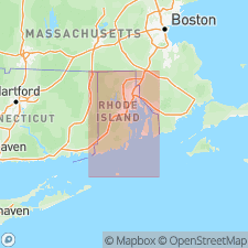
[Recognized in southern Narragansett basin, Avalon terrane (Esmond-Dedham subterrane), Narragansett Bay area, from approx. Lat. 41 deg. 30 min. to 42 deg. 00 min. N., and from approx. Long. 71 deg. 07 min. 30 sec. to 71 deg. 30 min. W., Providence 30- x 60-min quadrangle, Newport, Washington, and Bristol Cos., RI, and Bristol Co., MA.]
Source: Publication.
- Usage in publication:
-
- Narragansett Bay Group*
- Modifications:
-
- Adopted
- AAPG geologic province:
-
- New England province
GNC Staff, 2015, [U.S. Geologic Names Committee remarks on Narrangansett Bay Group (Pennsylvanian) of Rhode Island and Massachusetts]: U.S. Geological Survey, unpublished Geologic Names Committee note
Summary:
For more information, please contact Nancy Stamm, Geologic Names Committee Secretary.
Asterisk (*) indicates published by U.S. Geological Survey authors.
"No current usage" (†) implies that a name has been abandoned or has fallen into disuse. Former usage and, if known, replacement name given in parentheses ( ).
Slash (/) indicates name conflicts with nomenclatural guidelines (CSN, 1933; ACSN, 1961, 1970; NACSN, 1983, 2005, 2021). May be explained within brackets ([ ]).