The National Geologic Map Database is migrating to a new infrastructure. We apologize for any service disruptions during this process.
|
|---|


- Usage in publication:
-
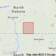
- Napoleon Drift
- Modifications:
-
- Named
- Geochronologic dating
- Dominant lithology:
-
- Till
- AAPG geologic province:
-
- Williston basin
Summary:
Probably named for town in Logan Co, ND. Name first used informally by Bonneville (1961, North Dakota Acad. Sci. Proc., v. 15, p.5-ll). Type area designated south of Napoleon in secs. 32,33 T135N, R72W and secs 4,5,8,9 T134N, R72W, Logan Co, Williston basin. Occurs in southwest Logan and northwest McIntosh Cos. Drifts described in this report are not lithostratigraphic units as defined by American Commission on Stratigraphic Nomenclature (1961) because drifts have been differentiated by their topographic form, geographic position, and inferred geologic history. Consists of till of ground moraine of Napoleon subdistrict plus all other associated drift that originated from the same glacial ice. Lithology of the four Wisconsin drifts in study area are nearly identical; most of till is light olive gray and contains about equal amounts of clay, silt and sand and about 5% pebbles, cobbles, and boulders. Napoleon till in the Wishek subdistrict is slightly sandier and is dusky yellow. Thickness averages 10 ft. At a few places overlies older till or iron oxide-cemented gravel but at most places it overlies bedrock; underlies Long Lake Drift (new). Geologic map; correlation chart. Assigned to early Wisconsin on basis of degree of weathering, drainage pattern, radiocarbon dating of peat that indicates drift is older than 38,000 yrs, and correlation with Tazewell drift in SD.
Source: GNU records (USGS DDS-6; Denver GNULEX).
- Usage in publication:
-
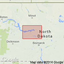
- Napoleon Drift, Till
- Modifications:
-
- Revised
- Overview
- AAPG geologic province:
-
- Williston basin
Summary:
Included within newly named Coleharbor Formation as an informal "inferential" unit. In ND most named drift units are generally indistinguishable on a regional scale though they can be related to a particular event in the history of a glacier. As drift units are recognized mainly on the basis of their inferred geologic history or origin, they are highly interpretive. All drift units in ND are included within the Coleharbor. Consists only of till (Napoleon till) in study area. Averages 15 ft thick and 25 ft thick respectively in western and southern McLean Co, ND, Williston basin. Overlies Mercer drift (new); underlies Lostwood drift (new). Early Wisconsinan (Pleistocene) age.
Source: GNU records (USGS DDS-6; Denver GNULEX).
For more information, please contact Nancy Stamm, Geologic Names Committee Secretary.
Asterisk (*) indicates published by U.S. Geological Survey authors.
"No current usage" (†) implies that a name has been abandoned or has fallen into disuse. Former usage and, if known, replacement name given in parentheses ( ).
Slash (/) indicates name conflicts with nomenclatural guidelines (CSN, 1933; ACSN, 1961, 1970; NACSN, 1983, 2005, 2021). May be explained within brackets ([ ]).