The National Geologic Map Database is migrating to a new infrastructure. We apologize for any service disruptions during this process.
|
|---|


- Usage in publication:
-
- Nannie Basin limestone
- Modifications:
-
- Original reference
- Dominant lithology:
-
- Limestone
- Clay
- AAPG geologic province:
-
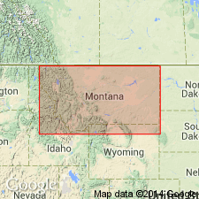
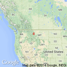
- Montana folded belt
Summary:
Pg. 6, 36, and passim. Nannie Basin limestone. At type locality (where it forms the lower cliffs which are the rim of physiographic feature known as Nannie Basin) [Una Mountain 7.5-min quadrangle, Powell County, northwestern Montana], consists of homogeneous gray-white, very massive thick-bedded, rather fine-grained limestone with a few beds of chocolate-gray limestone in upper part; in lower 28 feet there is also drab-gray nodular limestone with much buff clay in thin bands. The limestone weathers dull gray, and clay in lower part weathers buff. In nearly all other places Nannie Basin limestone is more tan than gray and has much more buff clay than at type locality. Thickest (203 feet) in Nannie Basin; thinnest (111 feet) on Wall Creek-Juliet Creek Ridge. Underlies Dearborn limestone and overlies Damnation limestone. Age is Middle(?) Cambrian.
Source: US geologic names lexicon (USGS Bull. 896, p. 1460).
- Usage in publication:
-
- Nannie Basin limestone†
- Modifications:
-
- Abandoned
- AAPG geologic province:
-
- Montana folded belt
Summary:
Pg. 38-39. †Nannie Basin limestone. Name Nannie Basin dropped and original Damnation and Nannie Basin limestones combined under Damnation limestone.
Source: US geologic names lexicon (USGS Bull. 1200, p. 2678-2679).
For more information, please contact Nancy Stamm, Geologic Names Committee Secretary.
Asterisk (*) indicates published by U.S. Geological Survey authors.
"No current usage" (†) implies that a name has been abandoned or has fallen into disuse. Former usage and, if known, replacement name given in parentheses ( ).
Slash (/) indicates name conflicts with nomenclatural guidelines (CSN, 1933; ACSN, 1961, 1970; NACSN, 1983, 2005, 2021). May be explained within brackets ([ ]).