The National Geologic Map Database is migrating to a new infrastructure. We apologize for any service disruptions during this process.
|
|---|


- Usage in publication:
-
- Naknek series*
- Modifications:
-
- Named
- Biostratigraphic dating
- Dominant lithology:
-
- Arkose
- Conglomerate
- AAPG geologic province:
-
- Alaska Southwestern region
- Alaska Peninsula province
Summary:
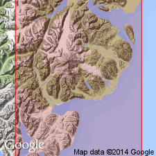
Outcrops about halfway from mouth of Naknek Lake to head at Savonoski [River]. Occupies most of section across peninsula, southwestern AK. Most of series are arkoses, sometimes fine, sometimes coarse, merging into conglomerates derived from hornblende-biotite-granite. In vicinity of Katmai basal rock is hard, massive granitic arkose overlain by dense andesitic rocks (perhaps a flow contemporaneous with sedimentary rocks), overlain by arkoses and coarse conglomerates. Series is cut through by andesitic-basaltic lava of later age. Arkoses of series contain abundant fossils which are probably Late Jurassic age (T.W. Stanton).
Source: GNU records (USGS DDS-6; Menlo GNULEX).
- Usage in publication:
-
- Naknek formation*
- Modifications:
-
- Revised
- Overview
- Areal extent
- AAPG geologic province:
-
- Alaska Peninsula province
- Alaska Southern region
- Alaska Southwestern region
Martin, G.C., 1926, Mesozoic stratigraphy of Alaska: U.S. Geological Survey Bulletin, 776, 493 p.
Summary:
Chisik conglomerate is reduced in rank to Chisik conglomerate member and assigned as basal member of Naknek formation. This overview paper includes historical summary, stratigraphic sections, and fossil lists of Naknek in Cook Inlet, Matanuska Valley, and Alaska Peninsula.
Source: GNU records (USGS DDS-6; Menlo GNULEX).
- Usage in publication:
-
- Naknek formation*
- Modifications:
-
- Revised
- AAPG geologic province:
-
- Alaska Peninsula province
- Alaska Southwestern region
Summary:
On Iniskin Peninsula, Naknek formation is divided into (ascending); Chisik member, siltstone member, Pomeroy member (new) and upper sandstone member. Age given as Late Jurassic.
Source: GNU records (USGS DDS-6; Menlo GNULEX).
- Usage in publication:
-
- Naknek Formation*
- Modifications:
-
- Age modified
- AAPG geologic province:
-
- Alaska Southern region
Summary:
Naknek Formation of Late Jurassic (Oxfordian and Kimmeridgian age) unconformably underlies Arkose Ridge Formation in lower Matanuska Valley, southern AK.
Source: GNU records (USGS DDS-6; Menlo GNULEX).
- Usage in publication:
-
- Naknek Formation*
- Modifications:
-
- Revised
- Overview
- AAPG geologic province:
-
- Alaska Southwestern region
Summary:
Naknek Formation in Iniskin-Tuxedni region is divided into (ascending): Chisik Conglomerate Member, lower sandstone member, Snug Harbor Siltstone Member (new), and Pomeroy Arkose Member. Report includes fossil lists, sections, areal distribution, mapping, thicknesses, correlations.
Source: GNU records (USGS DDS-6; Menlo GNULEX).
- Usage in publication:
-
- Naknek Formation*
- Modifications:
-
- Revised
- Overview
- AAPG geologic province:
-
- Alaska Southwestern region
Summary:
In Kamishak Bay region, Naknek Formation is divided into (ascending): Chisik Conglomerate Member, lower sandstone member, Snug Harbor Siltstone Member, Pomeroy Arkose Member and upper sandstone member. Stratigraphic sections, lithology, thicknesses, list of fossils included in report. Conformably, locally unconformably, overlies Chinitna Formation. Disconformably underlies Kaguyak Formation. Age is Oxfordian to Tithonian (Late Jurassic) based on pelecypods and ammonites.
Source: GNU records (USGS DDS-6; Menlo GNULEX).
- Usage in publication:
-
- Naknek Formation*
- Modifications:
-
- Revised
- Areal extent
- AAPG geologic province:
-
- Alaska Southwestern region
- Alaska Peninsula province
Summary:
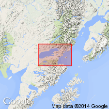
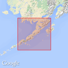
Naknek Formation. Unit geographically extended into area of report owing to geographic extension of its Chisik Conglomerate member (into Ugashik C-1 quadrangle, scale 1:63,360). Unit divided into (ascending): Chisik Conglomerate Member, Northeast Creek Sandstone Member (new) (in Sutwik Island D-5 quadrangle, scale 1:63,360), Snug Harbor Siltstone Member (in Sutwik Island D-5 quadrangle, scale 1:63,360), Indecision Creek Sandstone Member (new) (in Ugashik A-4 quadrangle, scale 1:63,360), and Katolinat Conglomerate Member (new) (in Katmai quadrangle). Age is Late Jurassic.
Source: Modified from GNU records (USGS DDS-6; Menlo GNULEX).
For more information, please contact Nancy Stamm, Geologic Names Committee Secretary.
Asterisk (*) indicates published by U.S. Geological Survey authors.
"No current usage" (†) implies that a name has been abandoned or has fallen into disuse. Former usage and, if known, replacement name given in parentheses ( ).
Slash (/) indicates name conflicts with nomenclatural guidelines (CSN, 1933; ACSN, 1961, 1970; NACSN, 1983, 2005, 2021). May be explained within brackets ([ ]).