- Usage in publication:
-
- Naked Girl Canyon Member
- Modifications:
-
- Named
- Dominant lithology:
-
- Fanglomerate
- Silt
- Sand
- Clay
- AAPG geologic province:
-
- Basin-and-Range province
Summary:
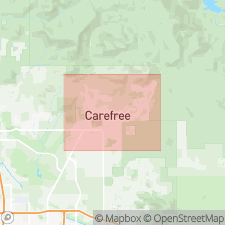
Named as member of Carefree Formation. Named for Naked Girl Canyon. Type locality is floor and walls of canyon within Willow Springs Wash 0.4 mi northeast of Spur Cross Rd, Cave Creek quad, northern Maricopa Co., central AZ. First described by Pewe and Doorn, 1989; Bergstrom and Silva, 1990. Fanglomerate facies found in northwestern part of Carefree basin from its western edge to 1 to 2 mi east of Fleming Springs Rd. Below surface veneer, deposits cover approx 4.0 sq mi of basin and 1.1 sq mi of area west of Cave Creek. Outcrop habit at type locality displays many small chutes, falls, and potholes from intermittent stream action. Consists of gray to light-gray moderately to well-bedded, poorly to moderately sorted, moderately to locally well consolidated fanglomerate in silty-sand matrix interbedded with tan to reddish-tan, unconsolidated to weakly consolidated, well-sorted playa-lake clay and silt facies, locally interbedded with sand and gravel lenses, (thought to be remnant of extinct playa, Lake Parks), and concentrated in west-central part of basin. Fanglomerate contains 40% basalt, 32% andesite, 9% tuff, 9% meta-argillite--phyllite. Clasts angular to subangular, up to 10 in. in diameter, become larger and more angular closer to their source. Maximum thickness of at least 1000 feet, based on data from lithologic well logs and cross sections. Conformably overlies Miocene andesite and basalt as well as Miocene (21.7 to 13.4 Ma) White Eagle Mine Formation (new). Laterally grades into late Miocene and early Pliocene Sombrero Member to east, Grapevine Member to southeast, and Galloway Member to south and southwest, all of Carefree Formation (all new). Overlying are all terrace gravels of Cave Creek (Pleistocene Schoolhouse Glacis Alluvium, and modern channel deposits of Holocene Cave Creek Alluvium and Holocene Rowe Wash Alluvium (all new)). Age is late Miocene and early Pliocene based on constraining minimum radiometric date of <13.4 Ma of underlying White Eagle Mine Formation. Moderately to steeply dipping attitude of fanglomerate's basal layers indicates deposition of unit took place when Basin-and-Range faulting occurred in area. Report includes geologic map and cross section, and stratigraphic nomenclature table.
Source: GNU records (USGS DDS-6; Denver GNULEX).
For more information, please contact Nancy Stamm, Geologic Names Committee Secretary.
Asterisk (*) indicates published by U.S. Geological Survey authors.
"No current usage" (†) implies that a name has been abandoned or has fallen into disuse. Former usage and, if known, replacement name given in parentheses ( ).
Slash (/) indicates name conflicts with nomenclatural guidelines (CSN, 1933; ACSN, 1961, 1970; NACSN, 1983, 2005, 2021). May be explained within brackets ([ ]).

