

- Usage in publication:
-
- Myers shale*
- Modifications:
-
- Named
- Dominant lithology:
-
- Shale
- Sandstone
- AAPG geologic province:
-
- Appalachian basin
Summary:
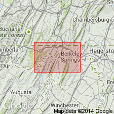
Named Myers shale for Myers place in the Meadow Brook valley, Berkeley Co., WV. Consists of largely bright-red crumbly shale and thin argillaceous sandstones, with, at base, thick cross-bedded dirty-gray gritty sandstone 60 feet thick. Unit is greater than 800 feet thick. It underlies the Pinkerton sandstone and overlies the Hedges shale; all are included in the Pocono group. The Myers is of Mississippian age.
Source: GNU records (USGS DDS-6; Reston GNULEX).
- Usage in publication:
-
- Myers shale*
- Modifications:
-
- Overview
- AAPG geologic province:
-
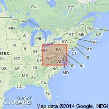
- Appalachian basin
Summary:
On the basis of paleobotanical studies and lithologic evidence, the Myers shale is correlated with the Mauch Chunk.
Source: GNU records (USGS DDS-6; Reston GNULEX).
- Usage in publication:
-
- Myers Shale
- Modifications:
-
- Overview
- Revised
- Age modified
- AAPG geologic province:
-
- Appalachian basin
Summary:
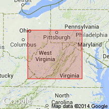
The Meadow Branch synclinorium, Berkley Co., WV, is composed of five formations: Rockwell, Purslane, Hedges, Myers, and Pinkerton, for many years assigned to the Pocono Group. The three basal units are retained as Early Mississippian (Kinderhookian and Osagean). Only the Purslane is correlative with the original Pocono Formation of northeastern PA. The Myers is 396 m thick in the Meadow Branch synclinorium, and consists for the most part of red shale. A basal yellow-buff sandstone approximately 30 m thick is here informally named the Little Mountain member. The Myers Shale is now correlated with the Late Mississippian (Meramecian) Maccrady Formation of southwestern VA. The Little Mountain member, however, is not known outside the synclinorium. The Myers was erroneously mapped as Hampshire on the WV State geologic Map (1968).
Source: GNU records (USGS DDS-6; Reston GNULEX).
For more information, please contact Nancy Stamm, Geologic Names Committee Secretary.
Asterisk (*) indicates published by U.S. Geological Survey authors.
"No current usage" (†) implies that a name has been abandoned or has fallen into disuse. Former usage and, if known, replacement name given in parentheses ( ).
Slash (/) indicates name conflicts with nomenclatural guidelines (CSN, 1933; ACSN, 1961, 1970; NACSN, 1983, 2005, 2021). May be explained within brackets ([ ]).