

- Usage in publication:
-
- Murphy Member
- Modifications:
-
- Original reference
- Biostratigraphic dating
- Dominant lithology:
-
- Sand
- Clay
- Conglomerate
- AAPG geologic province:
-
- Denver basin
Summary:
Pg. 275, 308-310, 349-351, figs. 1-4, 7, 14, 17. Murphy Member of Snake Creek Formation of Ogallala Group. Consolidated channel deposit. Consists of pink, tan, and gray sand and sandy clay, and includes at base, a conglomerate of sandstone pebbles. Thickness up to 32 feet. Is basal member of Snake Creek Formation (restricted). Unconformably underlies Laucomer Member (late Clarendonian NALMA) or, where absent, /Johnson Member (Hemphillian NALMA), both of Snake Creek Formation. Unconformably overlies Olcott Formation (new; early Barstovian NALMA) or, where absent, Sheep Creek Formation (restricted; late Hemingfordian NALMA), both of Hemingford Group. Sediments previously included in the Sheep Creek Formation. Fossils (vertebrates). Includes lower part of Snake Creek fauna. Age is considered middle Miocene (early Clarendonian NALMA), based on stratigraphic position and fossils.
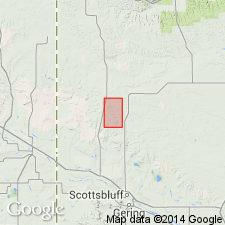
Type section: near the Murphy Ranch, on northeast side of Matthew's (Amer. Mus. Nat. Hist. Bull., v. 50, art. 2, p. 63, fig. 1, 1924) "Olcott Hill," in NE/4 SW/4 SE/4 sec. 3, T. 25 N., R. 55 W., [University Lake NW 7.5-min quadrangle], Sioux Co., northwestern NE. Named from James Murphy Ranch.
Other exposures: a small outcrop near type section, in Matthew's "East Draw"; and in slumped remnants of paleovalley walls at type section of /Johnson Member, in Matthew's "East PLIOHIPPUS Draw," in NE/4 NW/4 sec. 32 and southeastern corner of SW/4 sec. 29, T. 26 N., R. 55 W., [Chalk Buttes NE 7.5-min quadrangle], Sioux Co., northwestern NE.
Source: Publication; US geologic names lexicon (USGS Bull. 1564, p. 115).
For more information, please contact Nancy Stamm, Geologic Names Committee Secretary.
Asterisk (*) indicates published by U.S. Geological Survey authors.
"No current usage" (†) implies that a name has been abandoned or has fallen into disuse. Former usage and, if known, replacement name given in parentheses ( ).
Slash (/) indicates name conflicts with nomenclatural guidelines (CSN, 1933; ACSN, 1961, 1970; NACSN, 1983, 2005, 2021). May be explained within brackets ([ ]).