- Usage in publication:
-
- Murdock breccia
- Modifications:
-
- Named
- Dominant lithology:
-
- Breccia
- AAPG geologic province:
-
- Plateau sedimentary province
Summary:
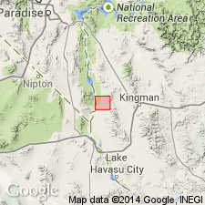
Named for Murdock mine, Mohave Co, AZ, Plateau sedimentary province. Occurs only in parts of secs 4 and 5, T19N, R20W, in two localities. Geologic map. No type locality designated. Overlies pre-Cambrian granite. Younger than Alcyone trachyte which was noted by Ransome (1923) as overlying an unnamed Tertiary breccia. Consists of granitic detritus with angular fragments and boulders of granite, gneiss, schist, quartz, and diorite? set in a matrix of angular grains of quartz and feldspar that were derived from the disintegration of granite. Shows little sorting. A greenish portion may be volcanic ash. Absence of sorting, angularity of boulders and smaller fragments suggest transport by stream under torrential conditions. Arid to semi-arid climate. Age uncertain; deposition during early Tertiary suggested.
Source: GNU records (USGS DDS-6; Denver GNULEX).
For more information, please contact Nancy Stamm, Geologic Names Committee Secretary.
Asterisk (*) indicates published by U.S. Geological Survey authors.
"No current usage" (†) implies that a name has been abandoned or has fallen into disuse. Former usage and, if known, replacement name given in parentheses ( ).
Slash (/) indicates name conflicts with nomenclatural guidelines (CSN, 1933; ACSN, 1961, 1970; NACSN, 1983, 2005, 2021). May be explained within brackets ([ ]).

