

- Usage in publication:
-
- Murdock Mountain Formation*
- Modifications:
-
- Original reference
- Biostratigraphic dating
- Dominant lithology:
-
- Dolomite
- Sandstone
- Siltstone
- Chert
- AAPG geologic province:
-
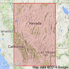
- Great Basin province
Summary:
[See also other papers, this vol.] Murdock Mountain Formation of Park City Group. Slope-forming cherty siltstone, silty chert, fine-grained sandstone, and thin beds of dolomite. Thickness 385.5 m [about 1,265 feet]. Middle formation of Park City Group, recognized in northeastern Nevada and northwestern Utah. Is a transitional unit laterally equivalent to the Plympton Formation (Park City Group) of west-central Utah and east-central Nevada, and to the Rex Chert Member (Phosphoria Formation) of southeastern Idaho and northeastern Utah; contains more fine-grained sandstone and chert than the predominantly dolomitic Plympton, and less bedded chert than the Rex Chert Member. At type, underlies Gerster Limestone of Park City Group and gradationally overlies Meade Peak Phosphatic Shale Tongue of Phosphoria Formation. Fossils (brachiopods, conodonts). Age is Early to Late Permian (late Artinskian to earliest Guadalupian; Roadian to earliest Wordian) of Furnish (1973, CSPG Mem., no. 2, p. 522-548) or Early Permian of USGS classification [ca. 1979].
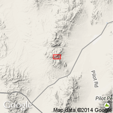
Type section: east flank of Murdock Mountain, in north-center sec. 36, T. 39 N., R. 67 E., Loray 7.5-min quadrangle, Leach Mountains, Elko Co., northeastern NV.
Source: Publication; US geologic names lexicon (USGS Bull. 1564, p. 115); Changes in stratigraphic nomenclature, 1979 (USGS Bull. 1502-A, p. A48).
- Usage in publication:
-
- Murdock Mountain Formation*
- Modifications:
-
- Areal extent
- AAPG geologic province:
-
- Great Basin province
Summary:
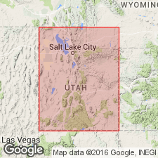
Unit geographically extended into report area [south Snake Mountains, Elko Co, NV]. Age given as Permian.
Source: GNU records (USGS DDS-6; Menlo GNULEX).
- Usage in publication:
-
- Murdock Mountain Formation*
- Modifications:
-
- Overview
- AAPG geologic province:
-
- Great Basin province
Summary:
Pg. 44-45 (fig. 63), 170 (chart 5), 172-173 (charts 9-12), 177 (chart 19). Murdock Mountain Formation. Recognized west of Great Salt Lake, [Box Elder and Tooele Counties], northwestern Utah, notably in Goose Creek Mountains, Terrace Mountain, Hogup Mountains, Lucin, Lemay Island, Grassy Mountains, and Lakeside Mountains areas. Where exposed, thickness 1,380 to 3,300 feet. Lies below Middle Permian Gerster Limestone (Gerster Formation) or, where absent, Triassic Dinwoody Formation. Lies above Early Permian Meade Peak Tongue (Meade Peak Member) of Phosphoria Formation. Age is Middle Permian (Guadalupian; Roadian to Wordian); conodont JINOGONDOLELLA NANKINGENSIS.
Source: Publication.
For more information, please contact Nancy Stamm, Geologic Names Committee Secretary.
Asterisk (*) indicates published by U.S. Geological Survey authors.
"No current usage" (†) implies that a name has been abandoned or has fallen into disuse. Former usage and, if known, replacement name given in parentheses ( ).
Slash (/) indicates name conflicts with nomenclatural guidelines (CSN, 1933; ACSN, 1961, 1970; NACSN, 1983, 2005, 2021). May be explained within brackets ([ ]).