The National Geologic Map Database is migrating to a new infrastructure. We apologize for any service disruptions during this process.
|
|---|


- Usage in publication:
-
- Murderers Creek Graywacke*
- Modifications:
-
- Overview
- AAPG geologic province:
-
- Blue Mountains province
Summary:
Pg. A26-A27, A29 (fig. 4). Murderers Creek Graywacke of Aldrich Mountains Group. Thickness ranges from 1,500 to 2,000 feet at type locality. Consists almost entirely of buff-weathering, medium- to fine-grained, calcareous graded graywacke and siltstone containing very little volcanic debris. Lenses of limestone breccia and breccia-conglomerate as much as 1,500 feet long and 120 feet thick occur locally at and near base of formation. Cobbles and blocks in the breccia generally range from 2 inches to 1 foot in maximum direction, but a few blocks as long as 20 feet have been noted; matrix is calcareous studded with well-rounded pebbles of limestone, chert, quartz, mudstone, and volcanic rock. Basal beds are buff-weathering calcareous siltstone and shale. Conformably overlies Laycock Graywacke of Aldrich Mountains Group; although some channel-type erosion is associated with the limestone breccias. In Riley Creek Butte, lowermost calcareous beds interfinger with tuff of Laycock, but elsewhere contact marks sharp change in lithology. Generally, conformably underlies Keller Creek Shale. Age is uncertain, but is believed to be no older than late Late Triassic, based on diagnostic Norian ammonite species (PLACITES, SANDLINGITES, and VREDENBURGITES) identified by N.J. Silberling (written commun., 1960), recovered from blocks in basal limestone breccia; indigenous ammonites resembling Lower Jurassic forms have also been found (R.W. Imlay, oral commun., 1963). consists of buff-weathering calcareous graded graywacke and siltstone; lenses of limestone breccia and conglomerate locally at base; some blocks in breccia are 20 ft across.
Source: Publication.
- Usage in publication:
-
- Murderers Creek Graywacke*
- Modifications:
-
- Named
- Dominant lithology:
-
- Graywacke
- Breccia
- AAPG geologic province:
-
- Blue Mountains province
Summary:
Murderers Creek Graywacke, second youngest formation of Aldrich Mountains Group (new). At type locality, consists almost entirely of medium- to fine-grained calcareous graywacke. Thickness 1,500 to 2,000 feet. Near type, at Ingle Rock and high on slope of Dans Creek, lenses of limestone breccia and breccia conglomerate (as much as 1,500 feet long and 120 feet thick) occur at and near base of formation. Appears to be conformable with underlying Laycock Graywacke (new) of Aldrich Mountains Group. Underlies Keller Creek Shale (new) of Aldrich Mountains Group. Age is Late Triassic(?).
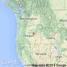
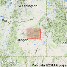
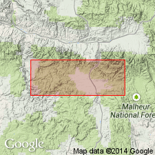
Type locality: steep slopes along both sides of Murderers Creek in southwestern part of Mount Vernon 15-min quadrangle, Grant Co., northeastern OR. Named from occurrence along Murderers Creek.
Source: US geologic names lexicon (USGS Bull. 1350, p. 516); supplemental information from GNU records (USGS DDS-6; Menlo GNULEX).
- Usage in publication:
-
- Murderers Creek Graywacke*
- Modifications:
-
- Age modified
- AAPG geologic province:
-
- Blue Mountains province
Summary:
Mapped in eastern Aldrich Mountains. Consists of graywacke, medium- to fine-grained, buff-weathering, with noncalcareous clasts in highly calcareous matrix. Buff-weathering medium-gray shale is near base of unit. Conformably overlies Laycock Graywacke in map area. Contains fossils in cobbles and blocks of Late Triassic and Paleozoic age (N.J. Silberling, written commun., 1960). Fossils most probably of Sinemurian age [Early Jurassic] (R.W. Imlay, written commun., 1961) occur in place west of HWY 395 in northeast corner of Logdell quad. Assigned Early Jurassic age.
Source: GNU records (USGS DDS-6; Menlo GNULEX).
For more information, please contact Nancy Stamm, Geologic Names Committee Secretary.
Asterisk (*) indicates published by U.S. Geological Survey authors.
"No current usage" (†) implies that a name has been abandoned or has fallen into disuse. Former usage and, if known, replacement name given in parentheses ( ).
Slash (/) indicates name conflicts with nomenclatural guidelines (CSN, 1933; ACSN, 1961, 1970; NACSN, 1983, 2005, 2021). May be explained within brackets ([ ]).