

- Usage in publication:
-
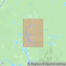
- Munsungun Lake Formation
- Modifications:
-
- Named
- Dominant lithology:
-
- Tuff
- Chert
- Volcanics
- Slate
- Dolomite
- AAPG geologic province:
-
- New England province
Summary:
Munsungun Lake Formation named in Piscataquis Co., north-central ME. Consists of fine-grained pyroclastic tuff, volcanic breccia, crystal and mixed tuffs, cherts, slates, and dolorite. Thickness approximately 1500 m. Includes Reed Pond Member. Conformably overlies Bluffer Pond Formation; unconformably underlies Spider Lake Formation, Carpenter Pond Formation (East Branch Group) and Upper Silurian and Lower Devonian rocks; conformably underlies Blind Brook Formation. Age is Middle Ordovician.
Source: GNU records (USGS DDS-6; Reston GNULEX).
- Usage in publication:
-
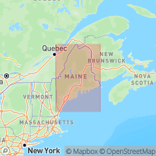
- Munsungun Lake Formation
- Modifications:
-
- Overview
- AAPG geologic province:
-
- New England province
Summary:
Munsungun Lake Formation is part of the late Middle Ordovician to early Late Ordovician volcanogenic tract in northern Maine. Rocks are largely felsic volcanic tuffs, agglomerates and flows. Subsidiary lithologies include sandstone, siliceous shale, and chert. Extensively intruded by diabase sills in the study area. Regionally extensive, cropping out in a belt over 60 km in length and 5 km in width. Total thickness is estimated to be 1500 m in the westernmost portion of the outcrop belt. Unconformably overlies the Lower Ordovician Chase Brook Formation and conformably overlies the Bluffer Pond Formation in the Munsungun Lake area where chert was extensively quarried by early humans for tool making. Elsewhere conformably underlies the Blind Brook Formation. The Middle Ordovician Munsungun Lake was deformed during the Devonian Acadian Orogeny.
Source: GNU records (USGS DDS-6; Reston GNULEX).
For more information, please contact Nancy Stamm, Geologic Names Committee Secretary.
Asterisk (*) indicates published by U.S. Geological Survey authors.
"No current usage" (†) implies that a name has been abandoned or has fallen into disuse. Former usage and, if known, replacement name given in parentheses ( ).
Slash (/) indicates name conflicts with nomenclatural guidelines (CSN, 1933; ACSN, 1961, 1970; NACSN, 1983, 2005, 2021). May be explained within brackets ([ ]).