The National Geologic Map Database is migrating to a new infrastructure. We apologize for any service disruptions during this process.
|
|---|


- Usage in publication:
-
- Munising sandstone*
- Modifications:
-
- Named
- Dominant lithology:
-
- Sandstone
- AAPG geologic province:
-
- Michigan basin
Summary:
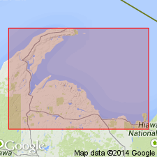
Munising sandstone is described as white or light-colored sandstone, 200-250 ft thick, composing uppermost part of Lake Superior sandstone of previous reports.
Source: GNU records (USGS DDS-6; Reston GNULEX).

- Usage in publication:
-
- Munising sandstone
- Modifications:
-
- Overview
- AAPG geologic province:
-
- Michigan basin
Summary:
Original Munising sandstone is the Franconia of Wisconsin.
Source: GNU records (USGS DDS-6; Reston GNULEX).
- Usage in publication:
-
- Munising formation
- Modifications:
-
- Overview
- AAPG geologic province:
-
- Michigan basin
Summary:
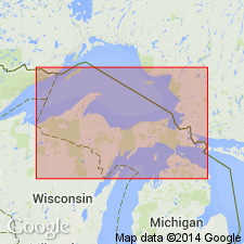
Lane and Seaman (1907) applied name Munising to upper 250 ft of "Lake Superior sandstone." Formation is discussed here in detail. Consists of (ascending) basal conglomerate--maximum thickness 15 ft; Chapel Rock member (new)--40-60 ft; Miners Castle member (new) --140 ft. Overlies Jacobsville with unconformity; underlies Au Train formation (new) with unconformity. Much of the confusion concerning correlation of the Munising results from inaccessibility of vertical Pictured Rocks cliffs, which constitute principal exposure of formation. Since section exposed in Pictured Cliffs is unfossiliferous and lithic units of WI cannot be traced into area, terminology of Cambrian of WI should not be used in northern MI.
Source: GNU records (USGS DDS-6; Reston GNULEX).
- Usage in publication:
-
- Munising Formation
- Modifications:
-
- Revised
- AAPG geologic province:
-
- Michigan basin
Summary:
Munising Formation assigned to Lake Superior Group. Includes Miners Castle Sandstone Member and Chapel Rock Sandstone Members. Age is Late Cambrian.
Source: GNU records (USGS DDS-6; Reston GNULEX).
- Usage in publication:
-
- Munising Formation, Group
- Modifications:
-
- Revised
- AAPG geologic province:
-
- Michigan basin
Summary:
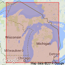
Munising retained at Formation rank north of line shown in fig. 8. In Upper Peninsula includes Miners Castle Sandstone and Chapel Rock Sandstone Members. In Lower Peninsula Munising raised to Group rank and includes Franconia Formation, Galesville Sandstone, and Eau Claire Formations.
Source: GNU records (USGS DDS-6; Reston GNULEX).
- Usage in publication:
-
- Munising Formation
- Modifications:
-
- Revised
- AAPG geologic province:
-
- Michigan basin
Summary:
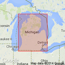
In the subsurface of MI, the Munising Formation of the Lake Superior Group includes (descending) the Franconia Sandstone Member, the Dresbach Sandstone Member, the Eau Claire Member, and the Mount Simon Sandstone Member. Unit underlies the Trempealeau Formation of the Lake Superior Group and overlies the Jacobsville Sandstone. Age is Late Cambrian.
Source: GNU records (USGS DDS-6; Reston GNULEX).
- Usage in publication:
-
- Munising Formation*
- Modifications:
-
- Redescribed
- AAPG geologic province:
-
- Michigan basin
Summary:
Munising Sandstone changed to Munising Formation, though it is still mostly sandstone. Divided into (ascending): unnamed conglomerate member, Chapel Rock, and Miners Castle Members. Age is Late Cambrian.
Source: GNU records (USGS DDS-6; Reston GNULEX).

- Usage in publication:
-
- Munising Group
- Modifications:
-
- Areal extent
- Revised
- AAPG geologic province:
-
- Michigan basin
Summary:
Munising extended to IN as Group within Potsdam Supergroup. In northwest IN, consists of the Franconia Formation (top), the Ironton Sandstone, the Galesville Sandstone, and the Eau Claire Formation. Unit includes only the Eau Claire in southwest IN, and only the Davis Formation (top) and the Eau Claire throughout most of the state. Underlies Potosi Dolomite and overlies Mount Simon Sandstone.
Source: GNU records (USGS DDS-6; Reston GNULEX).

- Usage in publication:
-
- Munising Formation
- Modifications:
-
- Overview
- AAPG geologic province:
-
- Michigan basin
Summary:
Nomenclature used in this report is that of the Michigan Geological Survey. Though presented as members of the Munising in this report, the Eau Claire, Franconia, and Dresbach should be reclassified as distinct formations in the subsurface of Michigan basin in the near future.
Source: GNU records (USGS DDS-6; Reston GNULEX).
- Usage in publication:
-
- Munising Group, Formation
- Modifications:
-
- Overview
- AAPG geologic province:
-
- Michigan basin
Summary:
In the southern peninsula of MI, Eau Claire, Galesville, and Franconia Formations are collectively referred to the Munising Group because of their genetic relations. In the northern peninsula, Munising is retained at formation rank. This nomenclature follows Catacosinos (1973, 1974).
Source: GNU records (USGS DDS-6; Reston GNULEX).
For more information, please contact Nancy Stamm, Geologic Names Committee Secretary.
Asterisk (*) indicates published by U.S. Geological Survey authors.
"No current usage" (†) implies that a name has been abandoned or has fallen into disuse. Former usage and, if known, replacement name given in parentheses ( ).
Slash (/) indicates name conflicts with nomenclatural guidelines (CSN, 1933; ACSN, 1961, 1970; NACSN, 1983, 2005, 2021). May be explained within brackets ([ ]).