

- Usage in publication:
-
- Mundy breccia*
- Modifications:
-
- Named
- Dominant lithology:
-
- Breccia
- Granite
- AAPG geologic province:
-
- Southwestern Basin-and-Range region
Summary:
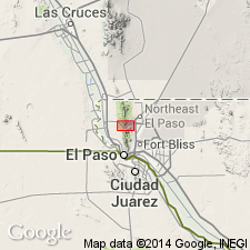
Named for spring located high on eastern slope of Franklin Mountain, El Paso Co, TX. Type locality designated at 1.5 mi southeast of North Franklin Mountain and 0.5 mi northwest of mouth of Fusselman Canyon. Occurs in single exposure in mapped area near southeast base of North Franklin Mountain, Southwestern Basin-and-Range region. Forms slope. Consists of dark-gray to black breccia composed of slightly rounded boulders and cobbles of basalt in dark-gray matrix; contains prominent granite dike inclined at low angle to bedding. Thickness ranges up to 250 ft; 190 ft thick at type. Unconformably overlies Castner limestone (new) with irregular contact; underlies [conformably?] Lanoria quartzite with sharply defined contact. Geologic map. Precambrian age based on stratigraphic position.
Source: GNU records (USGS DDS-6; Denver GNULEX).
- Usage in publication:
-
- Mundy Breccia
- Modifications:
-
- Overview
- AAPG geologic province:
-
- Southwestern Basin-and-Range region
Summary:
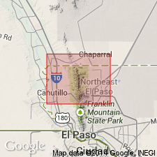
Unit mapped with underlying Castner Limestone is exposed at type locality on east flank of North Franklin Mountain and on north side of Hitt Canyon 0.6 mi south of TX-NM border in Franklin Mountains, El Paso Co, TX, Southwestern Basin-and-Range region. At Hitt Canyon, exposure is in a bulldozed prospect pit. Stratigraphic table. Generalized stratigraphic chart. Late Precambrian age.
Source: GNU records (USGS DDS-6; Denver GNULEX).
For more information, please contact Nancy Stamm, Geologic Names Committee Secretary.
Asterisk (*) indicates published by U.S. Geological Survey authors.
"No current usage" (†) implies that a name has been abandoned or has fallen into disuse. Former usage and, if known, replacement name given in parentheses ( ).
Slash (/) indicates name conflicts with nomenclatural guidelines (CSN, 1933; ACSN, 1961, 1970; NACSN, 1983, 2005, 2021). May be explained within brackets ([ ]).