- Usage in publication:
-
- Mullen Creek mafic complex
- Modifications:
-
- Named
- Dominant lithology:
-
- Basalt
- Diorite
- Gabbro
- AAPG geologic province:
-
- Northern Rocky Mountain region
Summary:
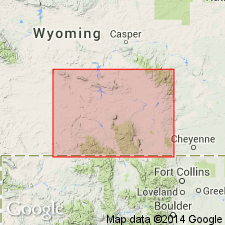
Name applied as an informal term to one of two major bodies of mafic rock south of the Mullen Creek-Nash Fork shear zone. Is located in T14N, R80W, Carbon Co, WY in the Northern Rocky Mountain region. Neither source of geographic name nor type locality stated. Is a large irregularly shaped body of mafic rocks present over approximately 60 sq mi area. Is truncated on northwest by the shear zone. Is cut by numerous bodies of granite and quartz monzonite. Cuts hornblende gneiss along east border. Is so metamorphosed on along its south border that it appears to grade into gneiss. Not known if body is a series of multiple intrusions or one large body; evidence suggest basalt first, then gabbro. Includes metabasalt, olivine gabbro, gabbro, diorite and quartz diorite. Olivine gabbro is the most abundant type. Most outcrops are coarse to medium grained. Along the borders of the complex, the units are amphibolitized and foliated; much of the rock is diorite to quartz diorite. Precambrian age.
Source: GNU records (USGS DDS-6; Denver GNULEX).

- Usage in publication:
-
- Mullin Creek mafic complex
- Modifications:
-
- Overview
- AAPG geologic province:
-
- Northern Rocky Mountain region
Summary:
Called "Mullin Creek mafic complex," "Mullin Creek layered mafic complex," and "Mullin Creek Complex" [spelled Mullen Creek in 1968 reports] in Medicine Bow Mountains, WY, Northern Rocky Mountain region. Lies about 20 km to west of Lake Owens Complex, and south of the Cheyenne belt, the suture zone separating the Archean Wyoming province to north from accreted island-arc terranes to the south. Is similar mineralogically and structurally to the Lake Owens. Cut by numerous granitic intrusions. Is metamorphosed to amphibolite grade. Bounded on north and west by Cheyenne belt, and on south and east by gneiss. Cut by a 1.778 +/-0.005 by granite. Is so disrupted that its stratigraphy is not well understood. May represent the lower crustal zone of a continental-margin magmatic arc complex. Intrudes a volcanogenic gneiss terrain. Probably was part of a larger layered complex that intruded the volcanic pile in Precambrian time.
Source: GNU records (USGS DDS-6; Denver GNULEX).
For more information, please contact Nancy Stamm, Geologic Names Committee Secretary.
Asterisk (*) indicates published by U.S. Geological Survey authors.
"No current usage" (†) implies that a name has been abandoned or has fallen into disuse. Former usage and, if known, replacement name given in parentheses ( ).
Slash (/) indicates name conflicts with nomenclatural guidelines (CSN, 1933; ACSN, 1961, 1970; NACSN, 1983, 2005, 2021). May be explained within brackets ([ ]).

