The National Geologic Map Database is migrating to a new infrastructure. We apologize for any service disruptions during this process.
|
|---|


- Usage in publication:
-
- Mulholland formation
- Modifications:
-
- Original reference
- Dominant lithology:
-
- Shale
- Siltstone
- Limestone
- Sandstone
- Tuff
- AAPG geologic province:
-
- Northern Coast Range province
- Sacramento basin
Summary:
Pg. 3, 6 (fig. 3), 14-16, pl. 1. Mulholland formation of Contra Costa group. Blue-gray to maroon lacustrine shales, siltstones, argillaceous limestone, pebbly sandstone; tuff bands, bentonite stringers, and limestone lentils common. Thickness 800 to 5,000 feet. [=? Savage and others' new unnamed formation (middle Pliocene flood-plain and lacustrine sediments) mentioned in their abstract (GSA Cordilleran Sec. Mtg., Los Angeles, GSA Bull., v. 62, no. 12, pt. 2, p. 1511, 1951).] Overlies Pinole tuff; unconformable below Pleistocene terraces. Age is early to middle Pliocene.
On p. 15 author states "Excellent exposures of Mulholland rocks are to be seen along the upper reaches of Kaiser and Cull Creeks, [east of Oakland in Las Trampas Ridge area, Las Trampas Ridge 7.5-min quadrangle, Alameda and Contra Costa Cos., western CA], which lie on strike with the type locality 7 miles northwest." [On p. 16 author states lacustrine beds in Las Trampas Ridge area correlate with the type Mulholland as recognized by Savage and others; they do not mention the Mulholland in their abstract.]
Source: Publication; US geologic names lexicon (USGS Bull. 1200, p. 2654).
- Usage in publication:
-
- Mulholland Formation
- Modifications:
-
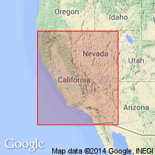
- Areal extent
- AAPG geologic province:
-
- Sacramento basin
Creely, Scott, Savage, D.E., and Ogle, B.A., 1982, Stratigraphy of upper Tertiary nonmarine rocks of central Contra Costa basin, California: Society of Economic Paleontologists and Mineralogists, Pacific Section, Field Trip Guidebook, Symposium, Anaheim, CA, April 14, 1982, p. 11-22.
Summary:
Pg. 14, 15 (fig. 3), 18. Mulholland Formation of Contra Costa Group. "The term 'Mulholland Formation' was proposed by us (Savage, Ogle, and Creely, 1951) in an oral presentation and was published by Ham (1952)." Consists of well bedded sedimentary rocks of lacustrine and fluvial origin, and several thin layers of tuff. Thickness approximately 1,160 m; top is eroded. Is uppermost formation of Contra Costa Group east of Moraga fault, in "Eastern Hills" area. Unconformably overlies and interfingers with Contra Costa Group, undifferentiated. Shown as age equivalent of Bald Peak Basalt, which is top formation of Contra Costa Group west of Moraga fault, in Berkeley Hills area. Fossils (vertebrates). Age is late Miocene (Hemphillian NALMA; "Jacalitos" and "Etchegoin" molluscan stages); positioned according to 1981 AAPG COSUNA charts.
Type section stated to be on northeast slopes of Mulholland Hill and on ridges immediately northeast thereof, in northeast limb of Mulholland syncline, Concord 15-min quadrangle, Contra Costa Co., western CA. Named from Mulholland Hill, just northeast of Moraga Valley and upper San Pablo Valley, [west of town of Rheem], Contra Costa Co., western CA.
Source: Publication.
For more information, please contact Nancy Stamm, Geologic Names Committee Secretary.
Asterisk (*) indicates published by U.S. Geological Survey authors.
"No current usage" (†) implies that a name has been abandoned or has fallen into disuse. Former usage and, if known, replacement name given in parentheses ( ).
Slash (/) indicates name conflicts with nomenclatural guidelines (CSN, 1933; ACSN, 1961, 1970; NACSN, 1983, 2005, 2021). May be explained within brackets ([ ]).