- Usage in publication:
-
- Muleshoe Volcanics
- Modifications:
-
- First used
- Geochronologic dating
- Dominant lithology:
-
- Breccia
- Tuff
- Lava
- Volcaniclastics
- AAPG geologic province:
-
- Pedregosa basin
Summary:
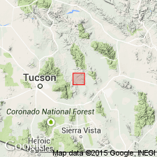
First published use as a name for some andesitic breccia, tuffs, lahar, lava flows, and reworked volcaniclastics. Named for Muleshoe Ranch, Galiuro Mountains, Cochise Co, AZ in the Pedregosa basin. No type locality designated. Predominantly monolithologic, gray, porphyritic hornblende-biotite andesite breccia; clasts are subangular, range from 2 mm to 60 cm in diameter; bedding is massive. Lava flows are porphyritic hornblende andesite. One sample of the andesite yielded a hornblende K-Ar date of 73.7 +/-1.8 Ma. The lahar has clasts angular to rounded 2 mm to 2 m in diameter of porphyritic andesite, porphyritic dacite, and banded vitrophyric rhyolite. Tuff silicic to intermediate occurs throughout; they are moderately welded, medium grained, and occur in sheets 5 to 15 m thick. One tuff near top yielded a K-Ar date of 76.5 +/-1.8 Ma on biotite. Volcaniclastic beds of sandstone, mudstone, and conglomerate make up 10 percent of the formation; some beds are cross-stratified; some channeling. Estimated at 700 m thick in Hot Springs Canyon. Geologic map. Cross section. Stratovolcanic environment suggested. Base not exposed. Upper contact gradational with Cascabel Formation (new name). Considered late Campanian to early Maastrichtian age. Previously mapped with Cascabel as an undivided Cretaceous or Paleocene unit.
Source: GNU records (USGS DDS-6; Denver GNULEX).
For more information, please contact Nancy Stamm, Geologic Names Committee Secretary.
Asterisk (*) indicates published by U.S. Geological Survey authors.
"No current usage" (†) implies that a name has been abandoned or has fallen into disuse. Former usage and, if known, replacement name given in parentheses ( ).
Slash (/) indicates name conflicts with nomenclatural guidelines (CSN, 1933; ACSN, 1961, 1970; NACSN, 1983, 2005, 2021). May be explained within brackets ([ ]).

