

- Usage in publication:
-
- Muldraugh formation
- Modifications:
-
- Named
- Dominant lithology:
-
- Limestone
- Siltstone
- AAPG geologic province:
-
- Cincinnati arch
Summary:
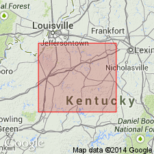
Named Muldraugh formation of Borden group. Consists of limestone, siltstone, shale, and chert. Overlies Floyds Knob formation: underlies Harrodsburg (Warsaw) limestone. Thickness ranges up to 95 ft. Occurs in central and north-central Kentucky.
Source: GNU records (USGS DDS-6; Reston GNULEX).
- Usage in publication:
-
- Muldraugh Formation
- Modifications:
-
- Areal extent
- AAPG geologic province:
-
- Cincinnati arch
Summary:
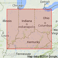
The name Muldraugh Formation, highest formation in the Borden Group, extended from Kentucky into southeastern Indiana. Muldraugh Formation there comprises the Floyds Knob Limestone Member, Edwardsville Member, and Ramp Creek Member, ascending.
Source: GNU records (USGS DDS-6; Reston GNULEX).
- Usage in publication:
-
- Muldraugh Member*
- Modifications:
-
- Revised
- AAPG geologic province:
-
- Cincinnati arch
Summary:
Muldraugh formation of Borden group of Stockdale (1939) reduced in rank to Muldraugh Member of Borden Formation. "Consists chiefly of cherty and dolomitic limestone and cherty, dolomitic, and calcareous siltstone that weather to a yellow-orange rubble. It is generally about 50 feet thick, but is locally as much as 100 feet thick. Laminae in the silty units are commonly contorted around small (less than 1 inch in diameter) chert and calcareous concretions. Shale and shaly siltstone occur locally in beds and partings. The dolomitic limestone is commonly fine to medium grained and silty and contains few fossils." Base is redefined to include the Floyds Knob formation of Stockdale (1939) which is considered an informal unit that serves as a marker bed in places. Conformably underlain by Halls Gap or Nancy Member of Borden Formation and conformably overlain by Salem and Warsaw Limestones in south-central Kentucky.
Source: GNU records (USGS DDS-6; Reston GNULEX).
- Usage in publication:
-
- Muldraugh Member*
- Modifications:
-
- Revised
- AAPG geologic province:
-
- Cincinnati arch
Summary:
Base of Muldraugh Member of Borden Formation was placed by Weir and others (1966) to generally include the glauconite seams which were called the Floyds Knob formation and separated from the Muldraugh formation by Stockdale (1939). Base of Muldraugh again raised in this publication to coincide with top of The highest glauconite seam. In south-central Kentucky, the glauconite seams assigned to the Halls Gap Member.
Source: GNU records (USGS DDS-6; Reston GNULEX).
- Usage in publication:
-
- Muldraugh Member*
- Modifications:
-
- Overview
- AAPG geologic province:
-
- Cincinnati arch
Summary:
Stratigraphic setting and use in north-central Kentucky of Muldraugh Member of Borden Formation as redefined by Weir and others (1966) and subsequently modified by Weir (1970).
Source: GNU records (USGS DDS-6; Reston GNULEX).
- Usage in publication:
-
- Muldraugh Formation
- Modifications:
-
- Revised
- AAPG geologic province:
-
- Cincinnati arch
Summary:
The Muldraugh Formation is removed from the Borden Group and assigned as the basal formation of the Sanders Group. Floyds Knob Limestone Member and Edwardsville Member removed from Muldraugh Formation and retained in Borden Group. Ramp Creek Member removed from Muldraugh Formation and raised in rank to Ramp Creek Formation. Ramp Creek is considered a lateral equivalent of the Muldraugh Formation, the Ramp Creek thickening and passing laterally to the southwest into the Muldraugh Formation across the Borden delta front. The Floyds Knob is made a member of the Edwardsville Formation.
Source: GNU records (USGS DDS-6; Reston GNULEX).
For more information, please contact Nancy Stamm, Geologic Names Committee Secretary.
Asterisk (*) indicates published by U.S. Geological Survey authors.
"No current usage" (†) implies that a name has been abandoned or has fallen into disuse. Former usage and, if known, replacement name given in parentheses ( ).
Slash (/) indicates name conflicts with nomenclatural guidelines (CSN, 1933; ACSN, 1961, 1970; NACSN, 1983, 2005, 2021). May be explained within brackets ([ ]).