- Usage in publication:
-
- Mudlick latite
- Modifications:
-
- Overview
- Dominant lithology:
-
- [Latite]
- AAPG geologic province:
-
- Midcontinent region
Summary:
Mudlick latite. Briefly summarized in report by W.C. Hayes, Precambrian rock units in Missouri, p. 83 (table 1), this volume. New names are credited to Tolman and Robertson (in prep.) [1969, Missouri Div. Geol. Survey Water Res. Rpt. Inv., no. 44 (Contrib. to Precambrian Geol., no. 1)]. Age is Precambrian.
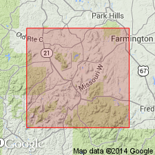
Occurs in St. Francois Mountain area. Mudlick Hollow and Mudlick Mountain are in Wayne Co., southeastern MO.
Source: Modified from US geologic names lexicon (USGS Bull. 1350, p. 513).

- Usage in publication:
-
- Mudlick dellenite
- Modifications:
-
- Principal reference
- Dominant lithology:
-
- Rhyodacite
- AAPG geologic province:
-
- Midcontinent region
Summary:
Mudlick dellenite. A pre-batholithic sill-like extrusive rock (rhyodacite) that appears to have intruded along zone of Ketcherside tuff, between Clark Mountain rhyolite of Middlebrook group and Annapolis rhyolite of Van East group. It can not be definitely correlated with either Middlebrook or Van East. Thickness approximately 700 to 1,200 feet. Age is Precambrian.
Type locality: exposures on Mudlick Mountain, in sec. 32, T. 30 N., R. 5 E., Sam A. Baker State Park, Wayne Co., southeastern MO.
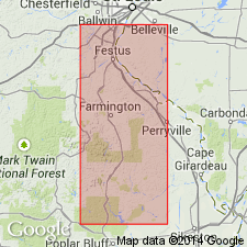
Exposures limited to St. Francois Mountains, southeastern Missouri: (1) on Mudlick Mountain (type); (2) in Lon Sanders Canyon, in sec. 23, T. 29 N., R. 3 E., and in two quarries on southern part of hill just west of Lon Sanders Canyon; (3) on knob east of Des Arc Mountain, in sec. 22, T. 30 N., R. 4 E.; west side of shut-ins in sec. 13, T. 30 N., R. 4 E; and (4) on Haley Mountain, in sec. 4, T. 29 N., R. 4 E.
Source: Modified from GNU records (USGS DDS-6; Denver GNULEX).

- Usage in publication:
-
- Mudlick Dellenite
- Modifications:
-
- Overview
- AAPG geologic province:
-
- Midcontinent region
Summary:
Composition is equivalent to the plutonic rocks granite, micromonzogranite or monzogranite porphyry and the volcanic rocks rhyodacite which is synonymous with quartz latite and dellenite. Though name dellenite implies extrusive origin, Mudlick is a shallow intrusive rock, possibly a sill. Crystallization began at a depth of at least 5,000 ft, at pressures of >/= to 500 bars, and temperatures of 795-830 degrees C. Chemical analyses. Map shows outcrops
Source: GNU records (USGS DDS-6; Denver GNULEX).
For more information, please contact Nancy Stamm, Geologic Names Committee Secretary.
Asterisk (*) indicates published by U.S. Geological Survey authors.
"No current usage" (†) implies that a name has been abandoned or has fallen into disuse. Former usage and, if known, replacement name given in parentheses ( ).
Slash (/) indicates name conflicts with nomenclatural guidelines (CSN, 1933; ACSN, 1961, 1970; NACSN, 1983, 2005, 2021). May be explained within brackets ([ ]).

