

- Usage in publication:
-
- Muddy Creek beds
- Modifications:
-
- Original reference
- Dominant lithology:
-
- Sand
- Clay
Summary:
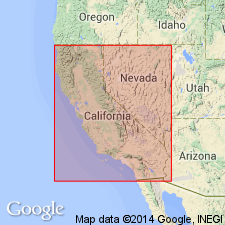
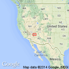
Pg. 147. Muddy Creek beds. Approximately 80 miles south of Panaca, in Meadow Valley, a second series of mammal-bearing deposits is exposed. These beds are mapped by Spurr as Pliocene. Between villages of Overton and Logan, Lincoln County, southeastern Nevada, and on southwestern side of Muddy River, the deposits rest unconformably on a series of beds that are presumably of early Tertiary age. Are also terraced, and yielded a small collection of mammalian remains, which differ from those in Panaca beds and suggest that northern and southern deposits are not of same age. Possibly the mammal-bearing beds of Muddy Valley, which may be designated Muddy Creek beds, are earlier in age than the Panaca deposits.
Source: US geologic names lexicon (USGS Bull. 896, p. 1448).
- Usage in publication:
-
- Muddy Creek formation*
- Modifications:
-
- First used
- Dominant lithology:
-
- Sand
- Silt
- Clay
- Gypsum
- Salt
- AAPG geologic province:
-
- Great Basin province
- Plateau sedimentary province
Summary:
Pg. 90+. Muddy Creek formation.
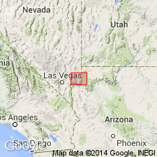
First published description in a comprehensive report. Name attributed to Stock (1921, an abstract) who assigned name Muddy Creek beds to some Pliocene-age, mammal-bearing, brown, well-indurated sandstone and clays between Overton and Logan, [Clark] Co, NV and on the southwest side of the Muddy River. Mapped (geologic map) as the Muddy Creek formation in this report in NV along Muddy Creek and Virgin River in NV in the Great Basin province, and in the Gyp Hills of adjacent Mohave Co, AZ in the Plateau sedimentary province. Consists of interbedded clay, silt, and sand. The fine-grained deposits are usually yellow or buff and the coarse-grained deposits are gray, though both types may be gray or white. Some coarse sand and gravel known near "margins." Pebbles and cobbles up to 12 inches in diameter of limestone, some chert and sandstone. Partial section measured near Overton Bridge at Muddy Creek. Gypsiferous layers 1 to 6 inches thick in upper Muddy Creek valley. Rock salt found at several localities in the Virgin Valley. Thickness estimated at 1,700 ft. Exposed thickness at Overton Ridge is 250 ft. Playa lake deposit in an arid to semiarid area. A thin widespread basalt flow present near middle part. Pliocene age assigned.
Source: GNU records (USGS DDS-6; Denver GNULEX).
- Usage in publication:
-
- Muddy Creek formation*
- Modifications:
-
- Revised
- Overview
- AAPG geologic province:
-
- Great Basin province
- Plateau sedimentary province
Summary:
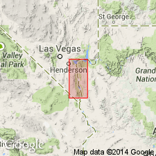
Mapped on both sides of Lake Mead and south on both sides of the Black Canyon of the Colorado River in Mohave Co, AZ, Plateau sedimentary province and in Clark Co, NV in the Great Basin province. Divisible into three map units at some localities--a lower part, breccia, and Fortification basalt member (named in this report) at top. Geologic map. Unconformably overlies Mount Davis volcanics (new). Member 1 at base includes: 1) bedded conglomerate interlayered with basalt flows 0-500 ft thick; 2) tuffaceous sandstone and siltstone 0-150 ft thick; 3) gypsum, limestone, clay, siltstone, and sandstone 0-1,500 ft thick. Member 2, in the middle, includes conglomerate, sandstone, shale, gypsum 0-300 ft thick. Member 3, at top, includes conglomerate and sandstone at depositional margins that grade basinward into siltstone, clay, tuff, gypsum 0-2,000 ft thick. The fourth member is cap of basalt--the Fortification--is 500 ft thick. Probably deposited in several adjacent basins. Pliocene? age assigned.
Source: GNU records (USGS DDS-6; Denver GNULEX).
- Usage in publication:
-
- Muddy Creek Formation
- Modifications:
-
- Revised
- Areal extent
- AAPG geologic province:
-
- Plateau sedimentary province
Summary:
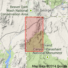
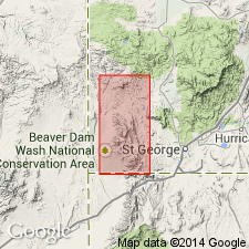
Revised in that unit unconformably overlies newly named Cottonwood Wash Formation in Virgin and Beaverdam Mountains, Mohave Co, AZ, Plateau sedimentary province. Unit extended into study area from Muddy Mountains, NV, 40 mi to west. Outcrops are limited to a few exposures in walls of Sand Hollow Wash and to an area of badlands in extreme northwest part of study area. Underlies thin, surficial deposits. Assigned Miocene? age.
Source: GNU records (USGS DDS-6; Denver GNULEX).

- Usage in publication:
-
- Muddy Creek Formation*
- Modifications:
-
- Revised
- Geochronologic dating
- AAPG geologic province:
-
- Plateau sedimentary province
- Great Basin province
Summary:
Upper contact revised in that the Hualapai formerly considered to be a formation above the Muddy Creek is reassigned to the Muddy Creek Formation as its uppermost member. [Reason for reassignment not stated.] Exposures of Muddy Creek and Hualapai studied for this report are north and south of Lake Mead at base of Grand Wash Cliffs of Mohave Co, AZ in the Plateau sedimentary province and in adjoining Nye Co, NV in the Great Basin province. May be more than 300 m thick. Basalt intercalated with the clastic rocks in the lower part of the Muddy Creek as 10.9 +/-1.1 m.y. by the K-Ar method. An air-fall tuff within the Hualapai Member has been dated at 8.44 +/-2.2 m.y. by the K-Ar method. Considered to be Miocene.
Source: GNU records (USGS DDS-6; Denver GNULEX).
- Usage in publication:
-
- Muddy Creek Formation*
- Modifications:
-
- Overview
- Areal extent
- AAPG geologic province:
-
- Plateau sedimentary province
- Great Basin province
Summary:
Present in Clark Co, NV, Great Basin province and Mohave Co, AZ, Plateau sedimentary province. Areal extent map shows present and probable original outcrops. Stratigraphic diagram shows identification of unit by region comparing this work with earlier workers. At least 215 m thick in valleys of Muddy and Virgin Rivers, NV; is 425+ m thick in Detrital Valley, AZ. Base exposed only at margins of valleys. Includes many rock types--pink sandstone, siltstone, and claystone that are chiefly parallel bedded and uniform thickness; gypsum, gypsiferous sandstone and siltstone, and arenaceous gypsum; conglomerate at basin margins. Halite and glauberite identified in surface exposures. Olivine and olivine-augite basalt flows present near Overton Arm, in Detrital Valley, and at Fortification Hill. Muddy Creek was deposited in alluvial, fluvial, and lacustrine environments. Fortification Basalt Member was extruded late in Muddy Creek deposition. Gypsiferous beds represent vadose crystallization in a playa or evaporite lacustrine crystallization in a lake. Basalt in lower part of Muddy Creek dated 10.8-11.6 m.y. Unit no older than 10.6 m.y. at Frenchman Mountain where it overlies unnamed red sandstone. Previously published K-Ar ages for Fortification summarized in table 1; author considers most reliable age is 5.88 +/-0.18 m.y. (reported by Damon and others, 1978, GSA Abs., p. 101-102). Assigned Tertiary [Miocene] age.
Source: GNU records (USGS DDS-6; Denver GNULEX).
- Usage in publication:
-
- Muddy Creek Formation
- Modifications:
-
- Geochronologic dating
- AAPG geologic province:
-
- Great Basin province
Summary:
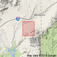
Occurs in Mesquite Basin that extends from west edge of Beaver Dam Mountain westward into NV and in here named Tobin Wash Basin which is small basin about 3 mi across and 30 sq mi in areal extent on southwestern edge of Bull Valley Mountains, Great Basin province. Unconformably overlies a variety of older rocks; overlain by high-level Quaternary-Tertiary alluvial deposits. Basalt flow within lower Muddy Creek has a K-Ar date of 8.8 +[-] 0.3 m.y. (E.H. McKee, 1985, personal comm.). Metcalf (1982, unpub. thesis, Univ. Nevada, Reno) obtained age dates of 6-12 m.y. on Muddy Creek near Las Vegas, NV. Miocene age.
Source: GNU records (USGS DDS-6; Denver GNULEX).
- Usage in publication:
-
- Muddy Creek Formation*
- Modifications:
-
- Geochronologic dating
- AAPG geologic province:
-
- Great Basin province
Summary:
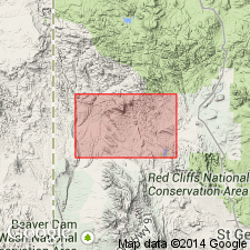
Mapped in southwest UT, Great Basin province. Composed of basin-fill clastic rocks. Near highlands, unit consists of coarse to very coarse boulder conglomerate and gravel with sparse interbedded light-tan pebbly sandstone grading basinward to light-tan buff indistinctly bedded, poorly consolidated pebbly sandstone, coarse sandstone, and sparse silty sandstone interbedded with sparse gravel and boulder conglomerate and light-gray to white tuff beds. Basalt lava flow enclosed within lower part of unit is exposed along Beaver Dam Wash in Motoqua quad and is separately mapped. Landslide blocks and sedimentary breccia located along Gunlock fault also separately mapped from main part of unit. Ranges up to several hundred meters thick. Overlies Ox Valley Tuff; underlies Pliocene? and Pleistocene landslide blocks and rubble and alluvium. A sample from basalt in lower part of Muddy Creek in sec 5, T40S, R19W, Washington Co, yielded a K-Ar age of 8.8 +/-0.3 Ma (Miocene).
Source: GNU records (USGS DDS-6; Denver GNULEX).
- Usage in publication:
-
- Muddy Creek Formation*
- Modifications:
-
- Mapped 1:24k
- AAPG geologic province:
-
- Great Basin province
Summary:
Mapped mostly in west-central and northwest part of quad, Clark Co, NV, Great Basin province. Consists of varicolored fine- to medium-grained sandstones and small amounts of siltstone and claystone; partly consolidated, poorly to well bedded; uppermost part contains thin conglomerate. Fossil remains of MEGATYLOPUS (camels), HEMIAUCHENIA (lamas), AELURODON (dogs), INDARCTOS (bear), EQUINAE (horses), and TEXOCEROS (pronghorns) immediately west of map area indicate medial Hemphillian (late Miocene) age (R.H. Tedford, unpub. data, 1978). Contains very localized thin bed of slightly reworked air-fall tuff; bed is about 160 m below top of Muddy Creek at edge of Mormon Mesa, about 2 km to west; bed is just below an indistinct contact with younger (Pleistocene) terrace alluvium of Virgin River and may lie within this unit. Uppermost gravels may be much younger than underlying part of Muddy Creek. Horse and puma teeth of Blancan (Pliocene) age have been found by other workers in similar gravels at southern tip of Mormon Mesa though equivalency of gravels not established. Altered claystone and sandstone around springs at Juanita Springs Ranch near southwest corner of quad separately mapped. Maximum exposed thickness is about 170 m; unconformably overlies Harrisburg Member of Kaibab Formation; unconformably underlies Pliocene alluvium of Bunkerville Ridge. Assigned Miocene and early Pliocene? age.
Source: GNU records (USGS DDS-6; Denver GNULEX).
For more information, please contact Nancy Stamm, Geologic Names Committee Secretary.
Asterisk (*) indicates published by U.S. Geological Survey authors.
"No current usage" (†) implies that a name has been abandoned or has fallen into disuse. Former usage and, if known, replacement name given in parentheses ( ).
Slash (/) indicates name conflicts with nomenclatural guidelines (CSN, 1933; ACSN, 1961, 1970; NACSN, 1983, 2005, 2021). May be explained within brackets ([ ]).