

- Usage in publication:
-
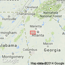
- Mud Creek Formation
- Modifications:
-
- Named
- Dominant lithology:
-
- Amphibolite
- Gneiss
- Schist
- Quartzite
- AAPG geologic province:
-
- Piedmont-Blue Ridge province
Summary:
The Mud Creek Formation of the New Georgia Group is here named in the Villa Rica antiform on the northwest limb of the Austell-Frolona antiform in west-central GA. It consists of amphibolite, hornblende gneiss, biotite gneiss, mica schist, and quartzite, and is divided into the Cedar Lake Quartzite Member and the Villa Rica Gneiss Member. Stratigraphically underlies and grades into the Andy Mountain and Bill Arp Formations of the informal Roosterville group. Age is Proterozoic (?).
Source: GNU records (USGS DDS-6; Reston GNULEX).

- Usage in publication:
-
- Mud Creek Formation†
- Modifications:
-
- Abandoned
- AAPG geologic province:
-
- Piedmont-Blue Ridge province
Summary:
The Mud Creek Formation of Abrams and McConnell (1981) of the New Georgia Group is here abandoned because recent mapping has shown that rocks designated by Abrams and McConnell as the type locality lie along the contact of the Zebulon Formation and the Villa Rica Gneiss and Ropes Creek Metabasalt. The Cedar Lake Quartzite Member is revised as the Cedar Lake Member of the Ropes Creek Metabasalt and the Villa Rica Gneiss Member is revised as the Villa Rica Gneiss of Pate (1980).
Source: GNU records (USGS DDS-6; Reston GNULEX).
For more information, please contact Nancy Stamm, Geologic Names Committee Secretary.
Asterisk (*) indicates published by U.S. Geological Survey authors.
"No current usage" (†) implies that a name has been abandoned or has fallen into disuse. Former usage and, if known, replacement name given in parentheses ( ).
Slash (/) indicates name conflicts with nomenclatural guidelines (CSN, 1933; ACSN, 1961, 1970; NACSN, 1983, 2005, 2021). May be explained within brackets ([ ]).