

- Usage in publication:
-
- Muav limestone*
- Modifications:
-
- Original reference
- Dominant lithology:
-
- Limestone
- Sandstone
- AAPG geologic province:
-
- Plateau sedimentary province
Summary:
Muav limestone of Tonto group. Impure thin-bedded bluish-gray limestone having characteristic mottled appearance imparted by numerous thin bands or lenses of buff or greenish shaly material. Thickness 450 to 475 feet. Consists of (descending): (1) mottled limestone, more shaly, 65 feet; (2) fine-grained white sandstone, 4 feet; (3) mottled limestone, 208 feet; (4) mottled limestone, more shaly, 45 feet; (5) mottled limestone, 23 feet. Unconformably underlies Redwall limestone; contact placed at base of a 110-foot thick unit of alternating layers of calcareous sandstone and dense blue-gray limestone of the Redwall. Conformably overlies Bright Angel shale. Is top formation of Tonto group. Is "mottled limestone" of Walcott. Age is Middle Cambrian, based on stratigraphic position. Correlates with Abrigo limestone of Bisbee area. Report includes geologic map.
Named from Muav Canyon, Grand Canyon district, in lower part of which the formation is well exposed.
Measured section 455 ft in Bass Canyon.
Source: US geologic names lexicon (USGS Bull. 896, p. 1447); supplemental information from GNU records (USGS DDS-6; Denver GNULEX).
- Usage in publication:
-
- Muav limestone*
- Modifications:
-
- Revised
- AAPG geologic province:
-
- Plateau sedimentary province
Summary:
Muav limestone of Tonto group. Transferred from Muav limestone to Bright Angel shale 58 [68?] feet of shaly beds containing near base a few beds of mottled limestone similar to mottled limestones of Muav limestone. Age is Middle Cambrian.
Source: US geologic names lexicon (USGS Bull. 896, p. 1447).
- Usage in publication:
-
- Muav limestone
- Modifications:
-
- Revised
- Biostratigraphic dating
- AAPG geologic province:
-
- Plateau sedimentary province
Summary:
Pg. 14 (fig. 2), 21-24, 80-110. Muav limestone of Tonto group. Restricted to mottled limestone facies. Includes minor amounts of platy, silty limestone and GIRVANELLA or algal limestones in marginal areas. Numerous excellent key beds which serve as time planes are developed in various parts of Muav formation. They clearly illustrate relation between facies distribution and time. Seven principal members [not adopted by the USGS] recognized in formation are here named (ascending) Rampart Cave, Sanup Plateau, Spencer Canyon, Peach Springs, Kanab Canyon, Gateway Canyon, aud Havasu. Newly named tongues are (ascending) Elves Chasm, Garnet Canyon, Lava Falls, Parashant, and Boucher. Thickness of formation as redefined varies from 130 feet near Little Colorado at eastern end of Grand Canyon to 827 feet along Grand Wash Cliffs at western end. Intertongues with Bright Angel shale to east. Age is Middle Cambrian, based on fossils [brachiopods, trilobites]. Report includes measured sections, cross sections.
Source: US geologic names lexicon (USGS Bull. 1200, p. 2648); supplemental information from GNU records (USGS DDS-6; Menlo GNULEX, Denver GNULEX), GNC index card files.
- Usage in publication:
-
- Muav Limestone*
- Modifications:
-
- Areal extent
- AAPG geologic province:
-
- Plateau sedimentary province
Summary:
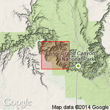
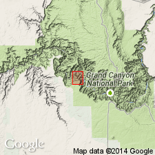
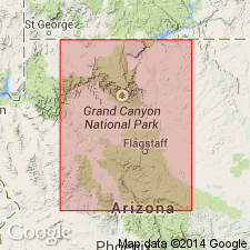
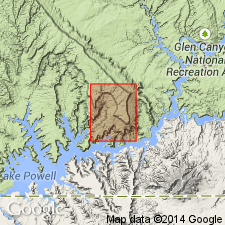
The name Muav Limestone of Middle Cambrian age geographically extended northward from AZ into the subsurface of Kane Co, UT, Plateau sedimentary province, where it overlies the Middle Cambrian Bright Angel Shale and unconformably underlies the Lower Devonian Elbert Formation. Muav is 434 ft thick. It consists of brown to gray silty dolomite and limestone, and some thin red to green shale and siltstone. It has oolites, chert, glauconite, and algal structures. Marine deposit.
Source: GNU records (USGS DDS-6; Denver GNULEX).
- Usage in publication:
-
- Muav Marble*
- Modifications:
-
- Redescribed
- Revised
- Areal extent
- Dominant lithology:
-
- Marble
- AAPG geologic province:
-
- Salton basin
Summary:
Names applied in Grand Canyon area extended geographically to sequence in Big Maria Mountains of southeast CA in the Salton basin with change of lithic designation. Cambrian Muav Limestone redescribed as Muav Marble. Muav consists of pure, coarse-grained, foliated calcite marble. Is 0.3 to 150 m thick. Contacts revised; overlies Bright Angel Schist (redescribed); underlies an unnamed Cambrian and Devonian marble. Equivalent to part of Bonanza King Limestone of northeast Mojave Desert and to upper part of Abrigo Formation of southern AZ. This part of California was part of the stable craton of North America in Paleozoic and early Mesozoic time. Rocks were intruded by Middle Jurassic granodiorite and metamorphosed in Cretaceous time.
Source: GNU records (USGS DDS-6; Denver GNULEX).

- Usage in publication:
-
- Muav Limestone*
- Modifications:
-
- Revised
- AAPG geologic province:
-
- Plateau sedimentary province
Summary:
Pg. 2 (fig. 1.1), 8-9, 10 (fig. 1.11), 11 (fig. 1.12). Muav Limestone. The uppermost dolomite beds originally included in Muav Limestone of Tonto Group [by Noble, 1914, USGS Bull. 549] are excluded and called Cambrian unclassified dolomite. Only about 20+/- feet preserved. Disconformably overlies Middle Cambrian platy thin-bedded limestones of Havasu Member of Muav Limestone. Disconformably underlies Devonian Temple Butte Limestone (or Formation), or where absent, Mississippian Redwall Limestone. The unclassified dolomite may correlate with dolomite underlying the Dunderberg Shale Member of Nopah Formation (Upper Cambrian) exposed along U.S. Route I-10 in Virgin River Gorge, [Mohave County], northwestern Arizona. Age is considered Late Cambrian. Report includes a schematic section (fig. 1.1).
Notable exposures along the Colorado River, at miles 35.1, 35.3, and 37.8 (mile 0 at Lees Ferry, [Glen Canyon National Recreation Area, Lees Ferry 7.5-min quadrangle, Coconino Co.], northern AZ).
[GNC remark (April 2023): This "unclassified dolomite" is now known as Frenchman Mountain Dolostone of Tonto Group. See Frenchman Mountain.]
Source: Publication.
- Usage in publication:
-
- Muav Dolostone*
- Modifications:
-
- Redescribed
- Dominant lithology:
-
- Dolostone
- AAPG geologic province:
-
- Plateau sedimentary province
Summary:
Is redescribed as dolostone. The name "dolostone" is used for rocks composed predominantly of the mineral "dolomite" on Figure 2 and throughout this chapter, although in the literature it has been common practice to use dolomite rather than dolostone in formal names of dolomitic formations and members. Occurs in stratigraphic column for northwest AZ (Plateau sedimentary province). Conformably above Bright Angel Shale (Middle Cambrian); unconformably below Temple Butte Limestone (Upper Devonian). Assigned to Middle and Upper? Cambrian.
Source: GNU records (USGS DDS-6; Denver GNULEX).
For more information, please contact Nancy Stamm, Geologic Names Committee Secretary.
Asterisk (*) indicates published by U.S. Geological Survey authors.
"No current usage" (†) implies that a name has been abandoned or has fallen into disuse. Former usage and, if known, replacement name given in parentheses ( ).
Slash (/) indicates name conflicts with nomenclatural guidelines (CSN, 1933; ACSN, 1961, 1970; NACSN, 1983, 2005, 2021). May be explained within brackets ([ ]).