The National Geologic Map Database is migrating to a new infrastructure. We apologize for any service disruptions during this process.
|
|---|


- Usage in publication:
-
- Moyers formation
- Modifications:
-
- Named
- Dominant lithology:
-
- Sandstone
- Shale
- AAPG geologic province:
-
- Ouachita folded belt
Summary:
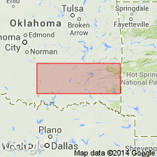
Named as middle formation (of 3) of Stanley group (raised in rank) of Pushmataha series (new) of the Bendian period. Type section designated at, and north of the village of Moyers, T2S, R16E, Pushmataha Co, OK in the Ouachita tectonic belt province. Makes up lower slopes of the mountains and ordinarily rises 100 to 150 ft above valley floor. Consists generally of alternating sandstones and shales aggregating a measurable thickness of about 1,100 ft; shale varies in color from blue to dark gray, green, olive-green, and greenish gray and the texture is flaky, splintery, and conchoidal; cone-in-cone structures common. Readily distinguishable by its fossiliferous siliceous shale with profuse Radiolaria at base; this shale is usually bluish green in color, but may vary from gray to dark gray; weathers in many parts of the area to cream and purple color. Thins to about 200 ft in western Ouachitas. Overlies Tenmile Creek formation (new) and underlies Chickasaw Creek siliceous shale (new), both of Stanley group of Pushmataha series of Bendian period. Upper sandstones have many plant remains. Conodonts occur throughout. Correlation chart. Columnar section of type section. Of Carboniferous age.
Source: GNU records (USGS DDS-6; Denver GNULEX).
For more information, please contact Nancy Stamm, Geologic Names Committee Secretary.
Asterisk (*) indicates published by U.S. Geological Survey authors.
"No current usage" (†) implies that a name has been abandoned or has fallen into disuse. Former usage and, if known, replacement name given in parentheses ( ).
Slash (/) indicates name conflicts with nomenclatural guidelines (CSN, 1933; ACSN, 1961, 1970; NACSN, 1983, 2005, 2021). May be explained within brackets ([ ]).