The National Geologic Map Database is migrating to a new infrastructure. We apologize for any service disruptions during this process.
|
|---|


- Usage in publication:
-
- Mountain Spring volcanics*
- Modifications:
-
- Named
- Dominant lithology:
-
- Schist
- Slate
- Tuff
- Shale
- AAPG geologic province:
-
- Sierra Nevada province
Summary:
Pg. 51, 52, 53, pl. 7. Series of schists and greenstone in Newton copper mine area (near Jackson, Amador County, California) tentatively correlated with the Jurassic Amador group described by Taliaferro, 1942 (GSA Bull., v. 53, no. 1), is subdivided into 4 formations (descending) Mountain Spring volcanics, Dufrene slate, Newton Mine volcanics, and Sunnybrook volcanics (all new). Mountain Spring volcanics consist of sequence of feldspathic chlorite schist, dark-blue-gray slate weathering pale-brown, and pale-green slaty tuffs with thin intercalations of dark-blue-gray shale. Approximate thickness 560 feet. In absence of fossil evidence, wider regional studies will be necessary to determine definitely whether Mountain Spring volcanics and underlying Dufrene slate should be considered uppermost Amador group or part of Mariposa slate. Measured section, along Mountain Spring Creek from Mariposa slate eastward, dips steeply to east; relation of beds to Mariposa slate suggests section is overturned, and is on west limb of an overturned anticline or its faulted equivalent. Overlies Dufrene slate. Age is Jurassic, based on tentative assignment to Amador(?) group. Mapped in Newton mine area (scale 1:400), slate shown separately.
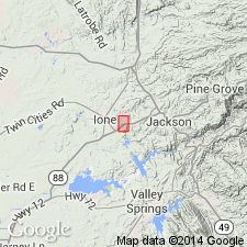
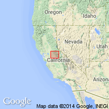
Named from exposures on Mountain Spring Creek, near Newton mine (6 mi west of Jackson [Sutter Creek 15-min quadrangle] Amador Co., east-central CA). [No type designated] but measured section along Mountain Spring Creek is about 560 feet thick.
Source: US geologic names lexicon (USGS Bull. 1200, p. 2621); GNU records (USGS DDS-6; Menlo GNULEX).
- Usage in publication:
-
- Mountain Spring volcanics
- Modifications:
-
- Not used
- AAPG geologic province:
-
- Sierra Nevada province
Summary:
Rocks of Mountain Spring volcanics tentatively correlated with Amador group by Heyl and Eric (1948, California Div. Mines Bull., no. 144, p. 52-53) are here assigned to Copper Hill volcanics.
[Author does not capitalize rank terms; however, units are considered formal.]
Source: Modified from GNU records (USGS DDS-6; Menlo GNULEX).
For more information, please contact Nancy Stamm, Geologic Names Committee Secretary.
Asterisk (*) indicates published by U.S. Geological Survey authors.
"No current usage" (†) implies that a name has been abandoned or has fallen into disuse. Former usage and, if known, replacement name given in parentheses ( ).
Slash (/) indicates name conflicts with nomenclatural guidelines (CSN, 1933; ACSN, 1961, 1970; NACSN, 1983, 2005, 2021). May be explained within brackets ([ ]).