- Usage in publication:
-
- Mount Watson Formation
- Modifications:
-
- Named
- Dominant lithology:
-
- Sandstone
- Arkose
- AAPG geologic province:
-
- Southern Rocky Mountain region
Summary:
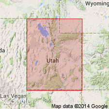
Named for Mount Watson in western Uinta Mountains, southwest Summit Co, north-central UT in Southern Rocky Mountain region. Is part of Uinta Mountain Group. Unit stratotype designated and described in secs 25 and 36 of T1S, R8E and also in secs 30 and 31, T1S, R9E, and is 607 m thick at this locality. Consists of predominantly very-light-gray or almost white interbedded quartz arenite and subarkose with minor pale-red or grayish-red arkosic arenite and grayish-green shale. Two boundary stratotypes proposed and described in detail: one at Bald Mountain, where lower contact with Moosehorn Lake formation of Wallace (1972, informal name from unpublished thesis) exposed; one at Hayden Peak, where upper contact with Hades Pass formation of Wallace (1972, informal name from unpublished thesis) exposed. Lower contact marked by typical light-colored sandstone overlying greenish shale of Moosehorn Lake unit. Upper contact marked by light-colored, thin-bedded sandstone and shale interbeds underlying red shale of Hades Pass unit. Light-colored arenites of Mount Watson Formation best distinguished from overlying beds on basis of pale color or, locally, by superjacent shale unit. Distinguished from underlying beds on basis of lithology. Ranges from 550 m (southeast) to 700 m (northwest) in thickness within study area. Isopach map, correlation chart, geologic and location maps. Of braided stream origin. Is Precambrian Y in age.
Source: GNU records (USGS DDS-6; Denver GNULEX).
For more information, please contact Nancy Stamm, Geologic Names Committee Secretary.
Asterisk (*) indicates published by U.S. Geological Survey authors.
"No current usage" (†) implies that a name has been abandoned or has fallen into disuse. Former usage and, if known, replacement name given in parentheses ( ).
Slash (/) indicates name conflicts with nomenclatural guidelines (CSN, 1933; ACSN, 1961, 1970; NACSN, 1983, 2005, 2021). May be explained within brackets ([ ]).

