- Usage in publication:
-
- Mount Rorah coal member
- Modifications:
-
- Original reference
- Dominant lithology:
-
- Coal
- AAPG geologic province:
-
- Illinois basin
Summary:
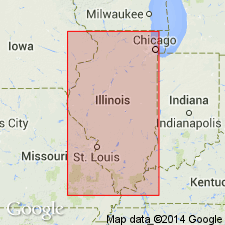
Pg. 33, 45 (table), 64, pl. 1. Mount Rorah coal member of Spoon formation (new) of Kewanee group (new). Proposed to replace Bald Hill coal because of prior use of name Bald Hill. Thickness about 2 feet. Stratigraphically above Creal Springs limestone member (new) and below Wise Ridge coal member (new). Age is Pennsylvanian. Presentation of new rock-stratigraphic classification of Pennsylvanian strata in Illinois. Cyclical classification is retained but is entirely independent of rock-stratigraphic classification.
Type locality: in SE/4 sec. 35, T. 10 S., R. 4 E., Williamson Co., southeastern IL. Named from Mount Rorah Church about 2 mi northwest of type outcrop.
Source: US geologic names lexicon (USGS Bull. 1200, p. 2639).

- Usage in publication:
-
- Mount Rorah Coal Member
- Modifications:
-
- Mapped 1:24k
- AAPG geologic province:
-
- Illinois basin
Summary:
Pg. 12 (chart), 38-39. Mount Rorah Coal Member of Spoon Formation. Widespread in southern Illinois; exposed in many places between towns of Creal Springs and Stonefort, and around Wise Ridge. Thickness ranges from less than a foot to about 45 inches, but it is commonly split with shale or claystone partings. Correlated in subsurface with coal in Perry and Jackson Counties, and tentatively with coal as far northeast as Lawrence County. Separated from underlying Creal Springs Limestone Member by 10 to 20 feet of medium-gray, soft, smooth to silty shale and rooted claystone. Separated from overlying Wise Ridge Coal Bed by 20 to 26 feet of dark-gray to black, silt-free, carbonaceous shale, grading into silty shale, siltstone, and sandstone. Age is Middle Pennsylvanian (Desmoinesian). Report includes geologic maps, stratigraphic columns. Retained as member rather than bed because of its apparent continuity.
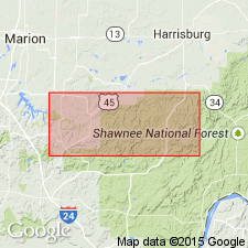
Type locality (corrected): ravine just east of the road at the northern edge of Stonefort village, in SW/4 NE/4 SE/4, sec. 25, T10 S., R. 4 E. Mount Rorah Church now Mount Moriah Church [Lat. 37 deg. 37 min. 08 sec. N., Long. 88 deg. 45 min. 49 sec. W., Creal Springs 7.5-min quadrangle, Williamson Co., southeastern IL].
[Additional locality information from USGS GNIS database and ACME Mapper 2.0, accessed Bastille Day 2009.]
Source: Publication; GNU records (USGS DDS-6; Reston GNULEX).
For more information, please contact Nancy Stamm, Geologic Names Committee Secretary.
Asterisk (*) indicates published by U.S. Geological Survey authors.
"No current usage" (†) implies that a name has been abandoned or has fallen into disuse. Former usage and, if known, replacement name given in parentheses ( ).
Slash (/) indicates name conflicts with nomenclatural guidelines (CSN, 1933; ACSN, 1961, 1970; NACSN, 1983, 2005, 2021). May be explained within brackets ([ ]).

