The National Geologic Map Database is migrating to a new infrastructure. We apologize for any service disruptions during this process.
|
|---|


- Usage in publication:
-
- Mt. Rat Schist
- Modifications:
-
- First used
- Dominant lithology:
-
- Schist
- Granulite
- AAPG geologic province:
-
- New England province
Summary:
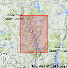
Hartland Group in the Cameron's Line thrust sheet includes the Mt. Prospect Formation [Prospect Formation?], the Mt. Rat Schist, and the Bee Brook Formation. In the Bantam Lake thrust sheet, the Hartland includes the Litchfield Schist and the Mt. Tom Amphibolite. The Mt. Rat consists of gray or silver-gray, rusty-weathering, laminated, garnet-plagioclase-muscovite-biotite-quartz schist that contains thin sandy quartz layers and irregular, red-stained quartz veins; black, rusty-weathering, highly fissile, biotite schist; and subordinate, siliceous granulites. Map symbol indicates a Cambrian(?) and Ordovician age.
Source: GNU records (USGS DDS-6; Reston GNULEX).
For more information, please contact Nancy Stamm, Geologic Names Committee Secretary.
Asterisk (*) indicates published by U.S. Geological Survey authors.
"No current usage" (†) implies that a name has been abandoned or has fallen into disuse. Former usage and, if known, replacement name given in parentheses ( ).
Slash (/) indicates name conflicts with nomenclatural guidelines (CSN, 1933; ACSN, 1961, 1970; NACSN, 1983, 2005, 2021). May be explained within brackets ([ ]).