The National Geologic Map Database is migrating to a new infrastructure. We apologize for any service disruptions during this process.
|
|---|


- Usage in publication:
-
- Mount Ord glaciation
- Modifications:
-
- First used
- Dominant lithology:
-
- Till
- AAPG geologic province:
-
- Black Mesa basin
Summary:
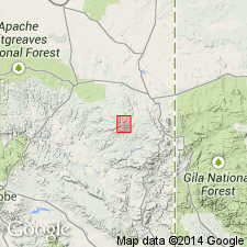
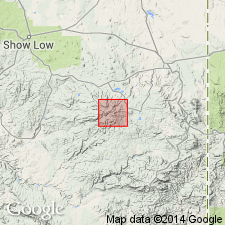
First? published use of name. Intent to name not stated. No type locality designated. Deposits of this glaciation restricted to a cirque on north face of Mount Ord in the White Mountains of Apache Co, AZ in the Black Mesa basin. Has a single moraine about 3 m wide, steep fronted, very bouldery, undissected. Has a well developed weak azonal soil about 12 cm thick. Weathering on boulders is minor. Some boulders larger than 10 m. Behind the moraine is a colluvial deposit 1.8 m in depth. The colluvium consists of clayey silt with occasional boulders. Lack of soil horizons in colluvium suggests continuous deposition. Disseminated charcoal at depth of 74 cm behind the moraine has an age of 2,815 +/-140 carbon -14 yrs BP. Maximum age for glacier is about 6,700 yrs. An early to middle Holocene age indicated. Correlation chart. Is the youngest of four glaciations recognized in this area.
Source: GNU records (USGS DDS-6; Denver GNULEX).
- Usage in publication:
-
- Mount Ord Glaciation
- Modifications:
-
- Overview
- AAPG geologic province:
-
- Black Mesa basin
Summary:
Glacier on Mount Ord was small -about 0.2 km. The single moraine is about 3 m wide, steep-fronted, very bouldery, not dissected. Has a weak zonal soil about 12 cm thick developed on sediment between the boulders. Weathering on boulders is minor. Behind the moraine is a deposit of colluvium about 1.8 m thick. Absence of soil horizons in colluvium suggests continuous deposition since the cirque was empty. Disseminated charcoal in colluvium at 74 cm has an age of 2,815 +/-140 carbon -14 years B.P. Assuming a constant rate of deposition the maximum age of the glacier would be about 6,700 yrs B.P. An early to middle Holocene age indicated.
Source: GNU records (USGS DDS-6; Denver GNULEX).
For more information, please contact Nancy Stamm, Geologic Names Committee Secretary.
Asterisk (*) indicates published by U.S. Geological Survey authors.
"No current usage" (†) implies that a name has been abandoned or has fallen into disuse. Former usage and, if known, replacement name given in parentheses ( ).
Slash (/) indicates name conflicts with nomenclatural guidelines (CSN, 1933; ACSN, 1961, 1970; NACSN, 1983, 2005, 2021). May be explained within brackets ([ ]).