- Usage in publication:
-
- Mount Holly series
- Modifications:
-
- Named
- Dominant lithology:
-
- Gneiss
- Schist
- AAPG geologic province:
-
- New England province
Summary:
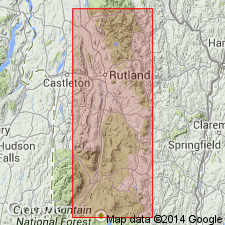
Named the Mount Holly series for Mount Holly, Wallingford quad., Rutland Co., southwestern VT. Unit is more metamorphosed and more variable [than overlying Mendon series] series of stratified rocks of Algonkian age, together with gneisses and schists of unknown origin, and abundant metamorphic equivalents of old basic igneous rocks. Consists of gneiss, quartzite, limestone, and schist.
Source: GNU records (USGS DDS-6; Reston GNULEX).
- Usage in publication:
-
- Mount Holly Complex*
- Modifications:
-
- Geochronologic dating
- AAPG geologic province:
-
- New England province
Summary:
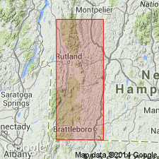
Two samples of augen gneiss from the Mount Holly Complex near the north end of the Green Mountain massif yield zircon concordia upper intercept ages of 1121+/-1 and 1119+/-3 Ma. Confirms belief than Green Mountain massif is isolated part of Grenville Province.
Source: GNU records (USGS DDS-6; Reston GNULEX).
- Usage in publication:
-
- Mount Holly Complex*
- Modifications:
-
- Revised
- Dominant lithology:
-
- Metavolcanics
- Metasedimentary
- Granite
- Gneiss
- AAPG geologic province:
-
- New England province
Summary:
Mount Holly Complex is here described as a 10-15 km-thick sequence of metavolcanic, metasedimentary, and metagranitoid rocks in the Green Mountains, Lincoln massif, and ancillary eastern domes in VT and immediately adjacent MA that have been affected by Grenvillian deformation. Granitic rocks of two textural groups are in contact with the Mount Holly: highly deformed gneissic granites are part of the Mount Holly, including College Hill Granite Gneiss (new). The late to post-tectonic granites are assigned to the Cardinal Brook Intrusive Suite. Mount Holly is unconformably overlain by Late Proterozoic and Early Cambrian Dalton Formation and Cheshire Quartzite.
Source: GNU records (USGS DDS-6; Reston GNULEX).
- Usage in publication:
-
- Mount Holly Complex*
- Modifications:
-
- Revised
- AAPG geologic province:
-
- New England province
Summary:
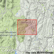
The Wilcox Formation, as used by Brace (1953), is assigned to the Mount Holly Complex in the Green Mountain massif of VT. Previous workers speculated that the contact between the Mount Holly and Wilcox was a fault, and therefore, two entirely different units. Author states that the contact between the two units is conformable or interfingering; this observation along with the similarity in lithology between the Wilcox and other parts of the Mount Holly Complex warrants including the Wilcox in the Mount Holly Complex. The age of the Wilcox is considered Middle Proterozoic since it is a part of the Mount Holly.
Source: GNU records (USGS DDS-6; Reston GNULEX).
- Usage in publication:
-
- Mount Holly Complex*
- Modifications:
-
- Geochronologic dating
- Overview
- AAPG geologic province:
-
- New England province
Summary:
Includes a suite of metatonalites, metatrondhjemite, and possible metadacite with chemical characteristics of a calc-alkaline volcanic-plutonic suite. Mappable units are College Hill Granite Gneiss and 10 unnamed subdivisions including several varieties of gneiss as well as schist, amphibolite, and quartzite. U-Pb zircon upper intercept ages of 1.35 to 1.30 Ga have been determined and interpreted as age of crystallization (Ratcliffe and others, unpub. data). Cores of abraded zircon obtained from College Hill Granite Gneiss of Mount Holly Complex have a U-Pb upper intercept age of 1245 +/-14 Ma, interpreted as crystallization age for that granite (Aleinikoff and others, 1990). Dust collected by abrasion of zircons, thought to represent migmatitic overgrowth, has a Pb-Pb age of approx 1100 Ma. These data suggest that College Hill Granite Gneiss was intruded at 1245 Ma and migmatized at 1100 Ma. On north and south slopes of College Hill, College Hill Granite Gneiss grades outward into migmatitic biotite granite gneiss of Mount Holly Complex. College Hill is discordant to contacts and folds in paragneiss units of Mount Holly Complex. Dacitic metavolcanics are found within Washington Gneiss of Berkshire massif of MA (Ratcliffe and Zartman, 1968). They are interbedded with thick succession of rusty-weathering, quartz-pebble gneisses, calc-silicate rocks and garnet-sillimanite schist similar to, but much thicker than, the rusty-weathering gneiss and schist unit of Mount Holly Complex exposed in Green Mountains of VT. It is possible that the metadacitic and metatrondhjemitic suite of VT constitutes a lateral, south-to-north facies of the Washington Gneiss of MA.
Source: GNU records (USGS DDS-6; Reston GNULEX).
- Usage in publication:
-
- Mount Holly Complex*
- Modifications:
-
- Revised
- AAPG geologic province:
-
- New England province
Summary:
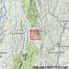
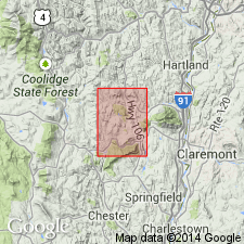
The Mount Holly Complex is revised to include the reinstated Cavendish Formation in the Chester dome area of VT. The Cavendish correlates with the Wilcox Formation of the Green Mountain massif and is of Middle Proterozoic age.
Source: GNU records (USGS DDS-6; Reston GNULEX).
For more information, please contact Nancy Stamm, Geologic Names Committee Secretary.
Asterisk (*) indicates published by U.S. Geological Survey authors.
"No current usage" (†) implies that a name has been abandoned or has fallen into disuse. Former usage and, if known, replacement name given in parentheses ( ).
Slash (/) indicates name conflicts with nomenclatural guidelines (CSN, 1933; ACSN, 1961, 1970; NACSN, 1983, 2005, 2021). May be explained within brackets ([ ]).

