

- Usage in publication:
-
- Mount Baldwin marble*
- Modifications:
-
- Named
- Dominant lithology:
-
- Marble
- Chert
- AAPG geologic province:
-
- Sierra Nevada province
Summary:
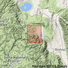
Type locality designated as east wall of canyon of Laurel Creek, few hundred ft east of end of west branch of Laurel Creek jeep trail, Mount Morrison 15' quad, Sierra Nevada, CA. Previously named Laurel Canyon formation by Mayo (1934). Exposed from type locality southeastward to south boundary of quadrangle, distance of 7 mi. Near south boundary strike swings eastward and formation terminates against granodiorite. Shown on geologic map as part of Bloody Mountain block. Consists of fine-grained bluish-gray to dark-gray marble; chert is locally abundant as irregular nodular beds and zones of nodules. Thickness is about 500 ft. Overlies Bright Dot formation (new); contact is generally sharp but locally gradational. Conformably underlies Mildred Lake hornfels (new). Age is Pennsylvanian on basis of brachiopods and crinoid columnals.
Source: GNU records (USGS DDS-6; Menlo GNULEX).
For more information, please contact Nancy Stamm, Geologic Names Committee Secretary.
Asterisk (*) indicates published by U.S. Geological Survey authors.
"No current usage" (†) implies that a name has been abandoned or has fallen into disuse. Former usage and, if known, replacement name given in parentheses ( ).
Slash (/) indicates name conflicts with nomenclatural guidelines (CSN, 1933; ACSN, 1961, 1970; NACSN, 1983, 2005, 2021). May be explained within brackets ([ ]).