The National Geologic Map Database is migrating to a new infrastructure. We apologize for any service disruptions during this process.
|
|---|


- Usage in publication:
-
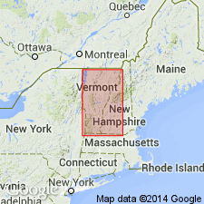
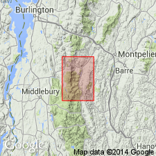
- Mount Abraham schist member
- Modifications:
-
- Named
- Dominant lithology:
-
- Schist
- AAPG geologic province:
-
- New England province
Summary:
Mount Abraham schist named member of Underhill formation in central VT. Consists of light-gray sericite (muscovite-paragonite)-quartz-chloritoid rock with silvery sheen. Porphyroblasts of magnetite common, and porphyroblasts of chlorite, chloritoid garnet, and kyanite present locally. Age is Cambrian(?).
Source: GNU records (USGS DDS-6; Reston GNULEX).
- Usage in publication:
-
- Mount Abraham schist*
- Modifications:
-
- Revised
- AAPG geologic province:
-
- New England province
Summary:
Mount Abraham schist raised to formation rank and assigned to Camels Hump group in Lincoln Mountain quadrangle. Lower part of the Mount Abraham on western slopes of Lincoln Mountain grades laterally westward into upper part of Unerhill formation. North of Mount Grant and Mount Cleveland, upper part grades laterally northeastward into lower part of Hazens Notch formation. In easternmost exposures, northeast of Lincoln Mountain, the Mount Abraham thins to extinction between Underhill and Hazens Notch formations Age is Early Cambrian(?).
Source: GNU records (USGS DDS-6; Reston GNULEX).

- Usage in publication:
-
- Mount Abraham Schist
- Modifications:
-
- Overview
- AAPG geologic province:
-
- New England province
Summary:
Four distinctive units of Mount Abraham Schist occur within the Fayston-Buels Gore area, which are recognized on the basis of mineralogy, contact relationships, and geographic distribution. All are composed predominantly of white mica (muscovite and paragonite)-quartz-chlorite-chloritoid schist. One unit contains intraformational greenstone and metawacke; a second is a similar white mica schist but without the greenstone and metawacke; the third contains allanite; and the fourth, kyanite.
Source: GNU records (USGS DDS-6; Reston GNULEX).
For more information, please contact Nancy Stamm, Geologic Names Committee Secretary.
Asterisk (*) indicates published by U.S. Geological Survey authors.
"No current usage" (†) implies that a name has been abandoned or has fallen into disuse. Former usage and, if known, replacement name given in parentheses ( ).
Slash (/) indicates name conflicts with nomenclatural guidelines (CSN, 1933; ACSN, 1961, 1970; NACSN, 1983, 2005, 2021). May be explained within brackets ([ ]).