- Usage in publication:
-
- Mounds Gravel
- Modifications:
-
- Named
- Dominant lithology:
-
- Gravel
- AAPG geologic province:
-
- Illinois basin
- Upper Mississippi embayment
Summary:
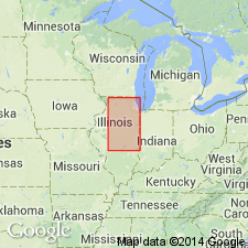
Mounds Gravel named as a formation in southern IL. Named for Mounds, Pulaski Co., part of which is on a ridge underlain by Mounds Gravel. Type section is exposure in gravel pit 3 mi west of Mounds SW1/4SW1/4SW1/4 sec. 7, T16S, R1W, Pulaski Co. Includes deposits previously called Orange Sand, Lafayette Gravel, Lafayette-type Gravel, Tertiary, Pliocene-Pleistocene, Continental Deposits, and other names by many workers. Commonly related to three terrace surfaces--the upper, called Karbers Ridge, Ozark, Calhoun, Lancaster, or Williana at an elevation of 580 to 620 ft; the middle, called McFarlan, Central Illinois, Bentley, or Smithland, at 450 to 500 ft; and the lower, called Elizabethtown, Montgomery, or Havana, at 380 to 400 ft. In addition, gravel similar in composition occurs locally at level of Ohio River at an elevation of about 300 ft. Nearly continuous in area south of Cache Valley; represented only by scattered pebbles north of the valley except in upland bordering Mississippi Valley south of Thebes, MO. Similar gravel occurs on top of Shawneetown Hills. Mounds Gravel consists of medium- to dark-brown chert pebbles, most of which are considerably rounded; completely angular pebbles are scarce. Contains abundant well-rounded quartz pebbles. Derived from Tennessee Valley and from Lake Superior region. Distinguished from Grover Gravel in that Mounds contains higher percentages of kyanite and staurolite than Grover, and its chert pebbles are darker brown and more polished. Includes Yarmouth Soil in top part at type section. Truncates Paleozoic, Mesozoic, and Tertiary formations, including Eocene Wilcox Formation near Cairo and Pliocene sediments farther south. Therefore, must be Pliocene or younger. At all levels, overlain by Illinoian Loveland Silt, but had been weathered and deeply eroded before Loveland deposition. Because of lack of glacial characteristics of gravel, it was assigned a Tertiary age; however, Tennessee Valley source can account for lack of glacial mineralogy. Also, evidence in Upper Mississippi Valley. although limited, suggests that deep valley incision followed Nebraskan glaciation and may have been initiated by Nebraskan glaciers establishing coarse of Mississippi River across Shawnee[town?] Hills. In view of these uncertainties, Mounds is assigned a Pliocene-Pleistocene age.
Source: GNU records (USGS DDS-6; Reston GNULEX).

- Usage in publication:
-
- Mounds Gravel*
- Modifications:
-
- Age modified
- Areal extent
- AAPG geologic province:
-
- Illinois basin
- Upper Mississippi embayment
Summary:
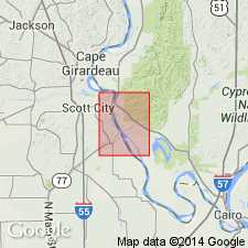
Mounds Gravel occurs in both IL and MO in quad. Mounds Gravel previously assigned to Upland Complex of Autin and others (1991) with Willis Formation of LA and TX and Citronelle Formation, which extends from TX to VA in Coastal Plain; they considered Uplands Complex to be older than early Pleistocene. Fisk (1944) considered these gravels to be of Pleistocene glacial origin. Potter (1955) argued for preglacial Pliocene age. Pliocene age is also supported by Lamar and Sutton (1930), Weller (1940), and Leighton and Willman (1949). Fossil flora from Citronelle has been interpreted as Pliocene by Stringfield and LaMoreaux (1957) and as early Pleistocene by Doering (1956, 1958). Doering (1960) showed Citronelle to be everywhere unconformable over Miocene rocks in Gulf Coast region and argued for preglacial Pleistocene age, but did not preclude possible Pliocene age. DuBar and others (1991) considered Citronelle to be Pliocene and found no evidence for preglacial early Pleistocene age. Isphording and Lamb (1971) report vertebrate fossils in Citronelle in AL that indicate a maximum age of middle Pliocene. May (181) argued that Citronelle represents part of a large-scale regressive continental deposit of Miocene age. Olive (1980) concluded that gravels of two ages occurred in KY: an upper-level gravel containing pollen of Miocene(?) and Pliocene age, and a lower-level reworked gravel containing Pleistocene pollen; he suggested that erosion and redistribution to lower elevations of older gravel began in late Pliocene and continued into early Pleistocene. Outcrops of Mounds in Thebes quad are at relatively high elevations and show no signs of reworking. Mounds is therefore assigned a Miocene(?) or Pliocene age. Both upper and lower contacts are pronounced unconformities.
Source: GNU records (USGS DDS-6; Reston GNULEX).
For more information, please contact Nancy Stamm, Geologic Names Committee Secretary.
Asterisk (*) indicates published by U.S. Geological Survey authors.
"No current usage" (†) implies that a name has been abandoned or has fallen into disuse. Former usage and, if known, replacement name given in parentheses ( ).
Slash (/) indicates name conflicts with nomenclatural guidelines (CSN, 1933; ACSN, 1961, 1970; NACSN, 1983, 2005, 2021). May be explained within brackets ([ ]).

