The National Geologic Map Database is migrating to a new infrastructure. We apologize for any service disruptions during this process.
|
|---|


- Usage in publication:
-
- Mossy Ridge lentil
- Modifications:
-
- Original reference
- Dominant lithology:
-
- Clay
- Shale
- Silt
- Sand
- AAPG geologic province:
-
- Arkla basin
Summary:
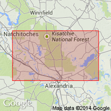
Pg. 101 (fig. 9), 103-104. Mossy Ridge lentil of Verda member of Yazoo clay of Jackson group. Ranges upward from lignitic clays, through silty shales and sandy clays, leaf-bearing silts, and lignitic sands to typical beach deposits of massive fossiliferous sands. Thickness about 12 feet. Occurs in upper part of member at about same stratigraphic horizon as Zenoria lentil (new). Age is late Eocene (Jackson).
Typically exposed in highway cuts north of Montgomery, in NW/4 sec. 10, T. 8 N., R. 5 W., and center of north line of sec. 18, T. 8 N., R. 3 W., Grant Parish, central LA.
Source: US geologic names lexicon (USGS Bull. 1200, p. 2616).
For more information, please contact Nancy Stamm, Geologic Names Committee Secretary.
Asterisk (*) indicates published by U.S. Geological Survey authors.
"No current usage" (†) implies that a name has been abandoned or has fallen into disuse. Former usage and, if known, replacement name given in parentheses ( ).
Slash (/) indicates name conflicts with nomenclatural guidelines (CSN, 1933; ACSN, 1961, 1970; NACSN, 1983, 2005, 2021). May be explained within brackets ([ ]).