The National Geologic Map Database is migrating to a new infrastructure. We apologize for any service disruptions during this process.
|
|---|


- Usage in publication:
-
- Mosherville sandstone member
- Modifications:
-
- Original reference
- Dominant lithology:
-
- Orthoquartzite
- AAPG geologic province:
-
- Appalachian basin
Summary:
Pg. 803, 806, 811. Name proposed for basal member of Gailor dolomite. Relatively pure typically massive white orthoquartzite with locally occurring porous cross-bedded brown iron-stained sandstone. Locally represented by conglomerate of dolomite and calcilutite with sand matrix; grades laterally into coarse sandstone. Lithologically similar to older Potsdam sandstone for which it has been mistaken. Thickness 4 to 7 feet. Unconformably overlies Galway formation (redefined) at type locality; overlies Hoyt limestone and Ritchie limestone in other areas.
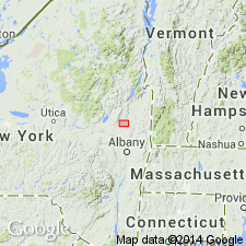
Roadcut 2 mi southwest of village of Galway, Saratoga Co., east-central NY. Other occurences include field exposures 0.5 mi south of Mosherville, Saratoga Co., east-central NY.
Source: US geologic names lexicon (USGS Bull. 1200, p. 2614).
For more information, please contact Nancy Stamm, Geologic Names Committee Secretary.
Asterisk (*) indicates published by U.S. Geological Survey authors.
"No current usage" (†) implies that a name has been abandoned or has fallen into disuse. Former usage and, if known, replacement name given in parentheses ( ).
Slash (/) indicates name conflicts with nomenclatural guidelines (CSN, 1933; ACSN, 1961, 1970; NACSN, 1983, 2005, 2021). May be explained within brackets ([ ]).