The National Geologic Map Database is migrating to a new infrastructure. We apologize for any service disruptions during this process.
|
|---|


- Usage in publication:
-
- Morton Member
- Modifications:
-
- Named
- Dominant lithology:
-
- Sandstone
- Siltstone
- AAPG geologic province:
-
- Williston basin
- Powder River basin
Summary:
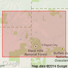
Named as middle member of Fall River Formation, upper formation of Inyan Kara Group. Named for its type well, the Dan C. Morton No. 1 Morton in center of SW 1/4, NE 1/4 sec 15, T54N, R68W, Crook Co, WY in the Powder River basin. Extends northward into southeast MT and western SD in the Williston and Powder River basins. Isopach map. Ranges from 0 to more than 50 ft thick. Is thickest in small area of southeast MT. Overlies the newly named Liscom Creek Member of Fall River. Underlies Coyote Creek Member of Fall River. E-log. Cross sections. Lies between 4,891 and 4,919 ft in the type well where it consists of gray, fine grained, slightly kaolinitic sandstone that grades downward into gray to buff siltstone. Has a porous sandstone facies between type and MT thought to be of shallow-neritic to littoral origin. This sandstone grades south and west into siltstone of offshore marine origin. The sandstone grades east into variegated claystone, siltstone, and sandstone facies of continental subaerial origin. This last facies includes carbonaceous debris and thin lignite beds. Based on distribution of porous, nearshore sandstone beds, the center of deltaic sedimentation was probably in southeast MT. Early Cretaceous. This is a study of subsurface data over the entire report area and of surface data collected from outcrops around Black Hills.
Source: GNU records (USGS DDS-6; Denver GNULEX).
For more information, please contact Nancy Stamm, Geologic Names Committee Secretary.
Asterisk (*) indicates published by U.S. Geological Survey authors.
"No current usage" (†) implies that a name has been abandoned or has fallen into disuse. Former usage and, if known, replacement name given in parentheses ( ).
Slash (/) indicates name conflicts with nomenclatural guidelines (CSN, 1933; ACSN, 1961, 1970; NACSN, 1983, 2005, 2021). May be explained within brackets ([ ]).