The National Geologic Map Database is migrating to a new infrastructure. We apologize for any service disruptions during this process.
|
|---|


- Usage in publication:
-
- Morgan formation
- Modifications:
-
- Named
- Dominant lithology:
-
- Sandstone
- Shale
- AAPG geologic province:
-
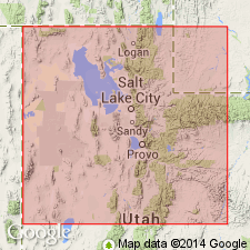
- Wasatch uplift
Summary:
[No type locality or description of the derivation of the name given. Could have been named for town of Morgan, Morgan Co, UT on the Wasatch uplift.] Is noted for its red color. Composed of sandstone and shale intercalated with thin limestone. Is about 500 to 2,000 ft thick. Overlies Mississippian limestone and underlies Weber quartzite in Weber Canyon. Is fossiliferous. Assigned to the Pennsylvanian.
Source: GNU records (USGS DDS-6; Denver GNULEX).
- Usage in publication:
-
- Morgan formation
- Modifications:
-
- Overview
- AAPG geologic province:
-
- Piceance basin
- Green River basin
Summary:
Name Morgan formation applied to a sequence of red and white sandstone with intercalated shale and crystalline marine limestone that is 525 ft thick near Irish Canyon in Moffat Co, CO, Greater Green River basin; 941 ft thick at Elk Spring, Rio Blanco Co, and 1,500+ ft thick at Cross Mountain, Rio Blanco Co, CO, Piceance basin. Unconformably overlies Mississippian rocks. Underlies Weber quartzite of Pennsylvanian (Des Moines to Late Pennsylvanian) age. Thought to be equivalent to Maroon formation and Belden shale of the Meeker area and areas to south. Sandstone in Morgan thought to have been derived from the Front Range highland. Fossils listed (fusulinids, brachiopods, bryozoans, etc.). Of Des Moines age. Measured sections, cross sections.
Source: GNU records (USGS DDS-6; Denver GNULEX).
- Usage in publication:
-
- Morgan formation
- Modifications:
-
- Revised
- AAPG geologic province:
-
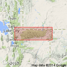
- Wasatch uplift
- Uinta uplift
- Uinta basin
- Green River basin
Summary:
Assigned as middle formation of the newly named Durst group. The Durst is known to extend from Morgan Co, UT on Wasatch uplift east along the Uinta Mountains in Duchesne and Uintah Cos, UT in the Uinta basin, and on the north side of the mountains in Daggett Co, UT on the Uinta uplift, into Moffat Co, CO in the Greater Green River basin. Morgan probably covers the same area as the Durst, except that it has been misidentified in some areas, and its upper contact has locally been misplaced, especially where the interbedded limestones in the Weber have been mistaken for Morgan. Overlies Hells Canyon formation and underlies Weber sandstone, both of Durst group. Hells Canyon may pinch out into Morgan. Correlation chart. Cross section. Of Des Moines, Pennsylvanian age.
Source: GNU records (USGS DDS-6; Denver GNULEX).
- Usage in publication:
-
- Morgan Formation*
- Modifications:
-
- Overview
- AAPG geologic province:
-
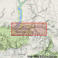
- Uinta basin
Summary:
As used in this report is restricted to interbedded red beds and limestones of Middle Pennsylvanian, Des Moines, age. Underlying Round Valley Limestone and overlying sandstone and limestone of Weber sandstone, previously included in Morgan by some authors, are excluded from the Morgan by this author. Usage here agrees with original use by Blackwelder (1910). Crops out discontinuously in area. Is conspicuous by its bright red color, a contrast to the drab colored Round Valley below and the Weber above. Is heterogeneous and slightly more than 80 ft thick. Composite section measured (81+ ft thick) in sec 24, T2N, R19E, and sec 15, T2N, R20E, Uintah Co, UT, Uinta basin, where formation consists of interbedded brick-red and purple-red siltstone, gray, lavender limestone, gray sandstone, red shale, and olive-green mudstone. Fossiliferous (bryozoans, brachiopods, crinoids). Deposited in a shallow offshore environment with unstable bottom conditions and fluctuating shoreline in a shallow trough. Thins northward grading into the Amsden Formation. Geologic map. Combined with Weber on an isopach map.
Source: GNU records (USGS DDS-6; Denver GNULEX).
- Usage in publication:
-
- Morgan Formation*
- Modifications:
-
- Areal extent
- AAPG geologic province:
-
- Green River basin
Summary:
Is present in Washakie basin of the Greater Green River basin in extreme south-central WY, where it overlies Madison Limestone and underlies Weber Sandstone. Ranges from 0-550 ft thick and is thought to be Morrow, Atoka, and Des Moines, or Early and Middle Pennsylvanian age. Correlates with: Quadrant Quartzite, Tensleep Sandstone, and Amsden Formation of Bighorn basin, Wind River basin, and Great Divide basin; part of Casper and Fountain Formations of Laramie basin; and parts of Hartville uplift; and Minnelusa Formation of Powder River basin.
Source: GNU records (USGS DDS-6; Denver GNULEX).
- Usage in publication:
-
- Morgan Formation*
- Modifications:
-
- Revised
- AAPG geologic province:
-
- Green River basin
Summary:
Overlies Belden Shale (rather than Round Valley Formation) in subsurface of Moffat Co, CO, Greater Green River basin. The pre-Weber Sandstone Pennsylvanian sequence in subsurface of report area assigned to Molas Shale, Belden Shale, and Morgan Formation. [Nearby on outcrop eastern part of Uinta Mountains, this same sequence divided into the Round Valley Limestone and overlying Morgan Formation.]
Source: GNU records (USGS DDS-6; Denver GNULEX).
For more information, please contact Nancy Stamm, Geologic Names Committee Secretary.
Asterisk (*) indicates published by U.S. Geological Survey authors.
"No current usage" (†) implies that a name has been abandoned or has fallen into disuse. Former usage and, if known, replacement name given in parentheses ( ).
Slash (/) indicates name conflicts with nomenclatural guidelines (CSN, 1933; ACSN, 1961, 1970; NACSN, 1983, 2005, 2021). May be explained within brackets ([ ]).