The National Geologic Map Database is migrating to a new infrastructure. We apologize for any service disruptions during this process.
|
|---|


- Usage in publication:
-
- Moreno formation*
- Modifications:
-
- Named
- Dominant lithology:
-
- Shale
- Sandstone
- AAPG geologic province:
-
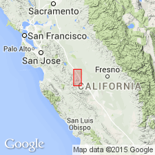
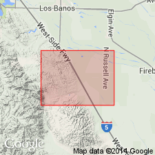
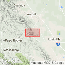
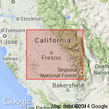
- San Joaquin basin
Summary:
Moreno formation. Upper formation of the Chico group. Present in Diablo Range, southern California. Rests conformably on the Panoche formation, the lower formation of Chico group, and is unconformably overlain by the Cantua sandstone member of Martinez(?) formation In southern area it consists of foraminiferal and diatomaceous maroon and chocolate-colored shale and dark clay shale with some interbedded sandstone, and has maximum thickness of 1,600 to 1,800 feet. In northern area it contains less shale of truly organic origin and more clay shale and sandstone and is unconformably overlain by the Tejon formation. Typically exposed in Moreno Gulch, on east flank of the Panoche Hills, where it is 1,700 to 2,000 feet thick and composed predominantly of thin-bedded, rather brittle brownish and lavender-colored shales that weather into small bits and flakes. In lower part of formation are numerous beds of sandstone, locally containing poorly developed concretions and in general similar to the sandstone of the Panoche formation. Upper half of the formation is more nearly pure shale and contains greater proportion of material of organic origin. Calcareous shale, limestone nodules, and layers of semi-porcelaneous siliceous shale occur locally, and near top of formation is a zone of white platy diatomaceous shale about 200 feet thick, which is traceable most of way along face of Panoche Hills, Fresno County. Line between the Moreno and Panoche formations is arbitrarily drawn at horizon where the sandstone beds that the form steep eastern slope of the Panoche Hills dip beneath the predominantly shaly beds. Age is Late Cretaceous.
Source: US geologic names lexicon (USGS Bull. 896, p. 1420); supplemental information from GNU records (USGS DDS-6; Menlo GNULEX).
- Usage in publication:
-
- Moreno formation
- Modifications:
-
- Revised
- AAPG geologic province:
-
- San Joaquin basin
Summary:
Pg. 256-257. In Tumey Hills region, disconformably underlies Lodo formation (new).
Source: US geologic names lexicon (USGS Bull. 1200, p. 2589).
- Usage in publication:
-
- Moreno group
- Modifications:
-
- Revised
- AAPG geologic province:
-
- San Joaquin basin
Summary:
Regarded as group in Chico series.
Source: US geologic names lexicon (USGS Bull. 1200, p. 2589)
- Usage in publication:
-
- Moreno shale*
- Modifications:
-
- Revised
- AAPG geologic province:
-
- San Joaquin basin
Summary:
Unit is shown as Moreno Shale. Age is Cretaceous.
Source: GNU records (USGS DDS-6; Menlo GNULEX).
- Usage in publication:
-
- Moreno formation
- Modifications:
-
- Revised
- AAPG geologic province:
-
- San Joaquin basin
Summary:
Pg. 7-11, pls. 2, 3, 4, 5. See also 1941 [abs.], GSA Bull., v. 52, no. 12, pt. 2, p. 1953-1954. Moreno formation. Subdivided in type area. Includes four members (ascending): Dosados sand and shale, Tierra Loma shale (including Mercy sandstone lentil), Marca shale, and Dos Palos shale (includes Cima sandstone lentil). Members mapped as lithogenetic units for distance of 35 miles. On the basis of this mapping it is concluded that Anderson and Pack (1915) show base of Moreno formation in [Ortegalito] Creek some 1,800 feet stratigraphically lower than their type Moreno in Moreno Gulch. Thickness about 3,700 feet. Underlies Paleocene glauconitic sandstone; overlies Panoche formation. Fossils [listed]. Age is Late Cretaceous to Paleocene(?).
Source: Publication; US geologic names lexicon (USGS Bull. 1200, p. 2589).
- Usage in publication:
-
- Moreno formation
- Modifications:
-
- Mapped
- AAPG geologic province:
-
- San Joaquin basin
Summary:
Described in Tumey Hills region. Moreno-Lodo boundary discussed. Age is Late Cretaceous and Paleocene.
Source: US geologic names lexicon (USGS Bull. 1200, p. 2589).
- Usage in publication:
-
- Moreno formation
- Modifications:
-
- Areal extent
- AAPG geologic province:
-
- San Joaquin basin
Summary:
Pg. 28-29, pls. 1, 2. Moreno formation, in Orchard Peak area, crops out only as single arctuate band of brown shale in Devil's Den syncline. This is southernmost surface exposure known. Not known which of Payne's members is represented at Devil's Den. Maximum exposed thickness, 900 feet, is on north limb of syncline. Formation thins southeastward to about 230 feet near eastern end of outcrop belt. Conformably overlies Red Man sandstone (new); underlies upper Eocene Canoas siltstone member of Kreyenhagen shale.
Source: US geologic names lexicon (USGS Bull. 1200, p. 2589).
- Usage in publication:
-
- Moreno Formation
- Modifications:
-
- Overview
- AAPG geologic province:
-
- San Joaquin basin
Summary:
zzzzzArea of report is Avenal Ridge-Reef Ridge area of southern Diablo Range, 200 miles southeast of San Francisco, in Fresno and Kings Counties, west-central California. Eight stratigraphic units ranging from Early to Late Cretaceous are recognized in area, in descending [ascending?] order: Badger Shale, Risco Formation, Johnson Peak Formation, Catskin Formation (new), Lovel Shale (new), Redman [Red Man] Sandstone, Willow Spring Mudstone (new), and Moreno Formation. All rocks are marine of shallow neritic to bathyl depths and consist of thick sequences of mudstone, shale, thin- to thick-bedded concretionary sandstones and conglomerates. Unconformities exist between [Red Man] (Campanian) and Willow Spring (Maastrichtian); [Red Man] and Lovel (Santonian); and Lovel and Catskin (Cenomanian to Coniacian).
Source: US geologic names lexicon (USGS Bull. 1350, p. 130, 443, 832); supplemental information from GNU records (USGS DDS-6; Menlo GNULEX).
- Usage in publication:
-
- Moreno Formation
- Modifications:
-
- Age modified
- Biostratigraphic dating
- AAPG geologic province:
-
- San Joaquin basin
Summary:
Age changed from Late Cretaceous and Paleocene(?) --to-- Late Cretaceous and Paleocene.
Source: Changes in stratigraphic nomenclature, 1971 (USGS Bull. 1372-A, p. A12-A13).
- Usage in publication:
-
- Moreno Formation*
- Modifications:
-
- Adopted
- Mapped
- Dominant lithology:
-
- Shale
- Sandstone
- Siltstone
- AAPG geologic province:
-
- San Joaquin basin
Summary:
Moreno Formation. Includes Payne's (1951) subdivisions (descending; separately mapped): Dos Palos Shale Member, Cima Sandstone Lentil, Marca Shale Member, Tierra Loma Shale Member, and Dosados Sandstone and Shale Member. Age is Late Cretaceous and Paleocene (Maestrichtian and Danian). Moreno Formation and its subdivisions adopted by the USGS.
Source: Publication; GNU records (USGS DDS-6; Menlo GNULEX).
For more information, please contact Nancy Stamm, Geologic Names Committee Secretary.
Asterisk (*) indicates published by U.S. Geological Survey authors.
"No current usage" (†) implies that a name has been abandoned or has fallen into disuse. Former usage and, if known, replacement name given in parentheses ( ).
Slash (/) indicates name conflicts with nomenclatural guidelines (CSN, 1933; ACSN, 1961, 1970; NACSN, 1983, 2005, 2021). May be explained within brackets ([ ]).