The National Geologic Map Database is migrating to a new infrastructure. We apologize for any service disruptions during this process.
|
|---|


- Usage in publication:
-
- Moppin metavolcanic series
- Modifications:
-
- Named
- Dominant lithology:
-
- Volcanics
- AAPG geologic province:
-
- Southern Rocky Mountain region
Summary:
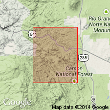
Named for exposures in upper Spring Creek just north of Moppin Ranch [Spring Creek is in secs 32, 33, T28N, R8E and sec 3, T27N, R8E, Las Tablas quad, Rio Arriba Co, NM in the Southern Rocky Mountain region. No type locality designated]. The same rocks were called Hopewell series by Just (1937) but that name is preempted, and rocks renamed Moppin metavolcanic series in this report. Occurs in Buckhorn Gulch, west fork of Duran Creek, Apache Canyon, Biscara Canyon, and on northeast side of Tusas Valley. Is a greenschist and amphibolite with thin layers of schist, gneiss, phyllite, and conglomerate locally. Is intruded by Burned Mountain metarhyolite, by Maquinita granodiorite, and by Tres Piedras granite. Believed to be metamorphosed volcanic rocks. Assigned to the Precambrian. Geologic map.
Source: GNU records (USGS DDS-6; Denver GNULEX).
- Usage in publication:
-
- Moppin Metavolcanics*
- Modifications:
-
- Redescribed
- AAPG geologic province:
-
- Southern Rocky Mountain region
Summary:
Name changed from Moppin Metavolcanic Series to Moppin Metavolcanics. Includes amphibolites formerly considered to be part of Kiawa Mountain Formation (a term abandoned in this report) by Barker (1958), to silicic metavolcanic rocks formerly assigned to Burned Mountain Metarhyolite in Las Tablas 15 min quad, and to other metamorphosed mafic volcanic and volcaniclastic rocks. Is older than, and locally interlayered with, Burned Mountain. Is an Early Proterozoic unit in the Tusas Mountains, Rio Arriba Co, NM in the Southern Rocky Mountain region. Was intruded by Maquinita Granodiorite and Tres Piedras Granite 1,700 m.y. ago, and by Tusas Mountain Granite about 1,500 m.y. ago, or in the Early Proterozoic. Stratigraphic table; generalized geologic map.
Source: GNU records (USGS DDS-6; Denver GNULEX).
- Usage in publication:
-
- Moppin Complex
- Modifications:
-
- Revised
- Geochronologic dating
- Dominant lithology:
-
- Schist
- Amphibolite
- Conglomerate
- Iron-formation
- Volcanics
- AAPG geologic province:
-
- Southern Rocky Mountain region
Summary:
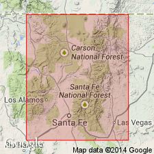
Name changed from "Moppin metavolcanic series" and "Moppin Metavolcanics" to Moppin Complex because the former rank designation does not reflect the diverse lithologies--volcanic, volcaniclastic, and epiclastic--present. Is metamorphosed, multiply deformed, and has intrusive rocks. Exposures of Moppin are in northern Tusas Mountains from American Creek, T28N, R8E to Hopewell Lake and Placer Creek, T29N, R6E along east side of Jawbone Mountain, Rio Arriba Co, NM in the Southern Rocky Mountain region. Is primarily chlorite schist and/or amphibolite with lesser amounts of feldspathic schist and gneiss, muscovite schist, metaconglomerate, and banded iron-formation. Local primary volcanic and sedimentary structures include graded beds, pillows. Associated with or intruded by? several granodiorites known as the Maquinita Granodiorite and associated with the trondhjemite of Rio Brazos. The trondhjemite has an Rb-Sr whole rock isotope age of 1,654 +/-34 Ma. Contacts with the trondhjemites, etc are deformed. Three reference sections: 1) Iron Mountain, sec 30, T29N, R7E; 2) Brazos Box, T29N, Rs5-6E; 3) Cleveland Gulch, T28N, Rs7-8E. Considered to be older than 1,755 Ma, or Early Proterozoic. Nomenclature chart. Geologic map.
Source: GNU records (USGS DDS-6; Denver GNULEX).
For more information, please contact Nancy Stamm, Geologic Names Committee Secretary.
Asterisk (*) indicates published by U.S. Geological Survey authors.
"No current usage" (†) implies that a name has been abandoned or has fallen into disuse. Former usage and, if known, replacement name given in parentheses ( ).
Slash (/) indicates name conflicts with nomenclatural guidelines (CSN, 1933; ACSN, 1961, 1970; NACSN, 1983, 2005, 2021). May be explained within brackets ([ ]).